FOREST METRICS FROM LIDAR
We have been working with stakeholders in forestry to measure complete timber stand biometrics. Flights were conducted using a multi-sensor payload consisting of a multi-spectral camera and LiDAR.
HOW WE EXTRACT DATA FROM LIDAR
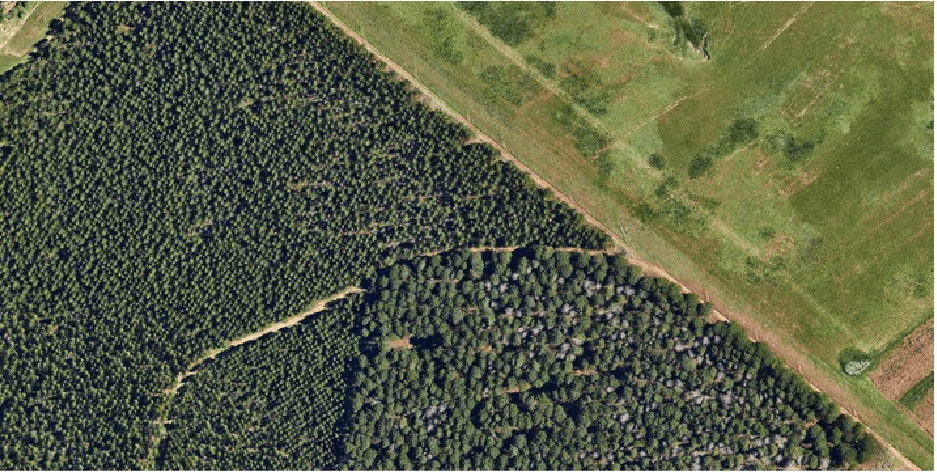
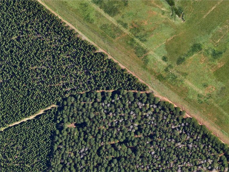
This is a representative snippet at the junction of three stands of different ages and varieties where a number of trees had been infected by Diplodia pinea fungus.
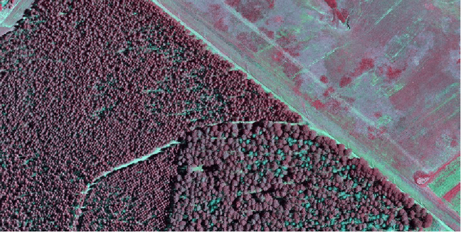
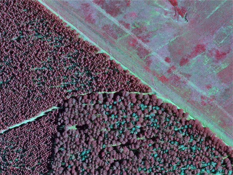
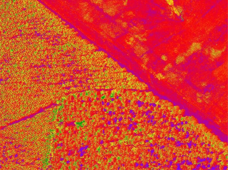
We have swapped the blue channel for the near-infrared image. This helps poorly growing vegetation stand out as grey as it reflects poorly in the infrared range.
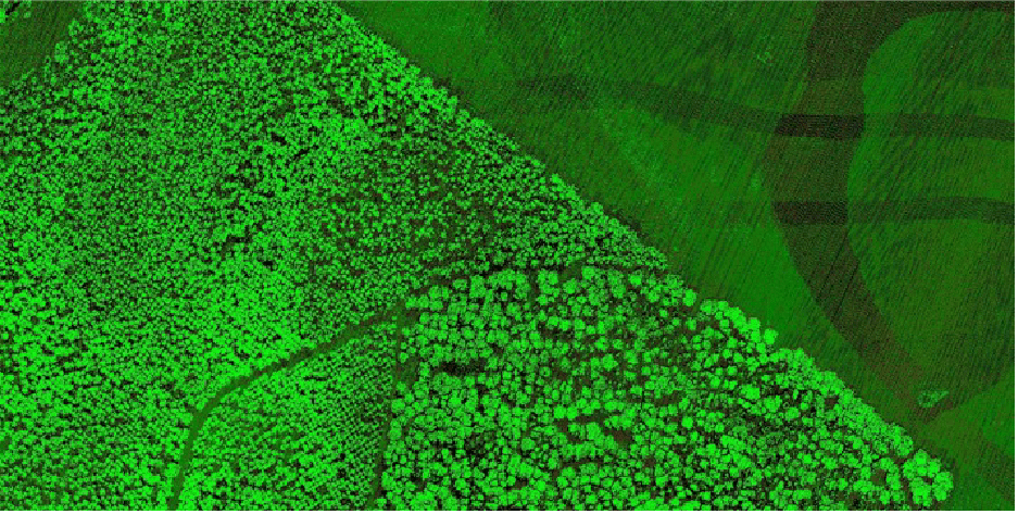
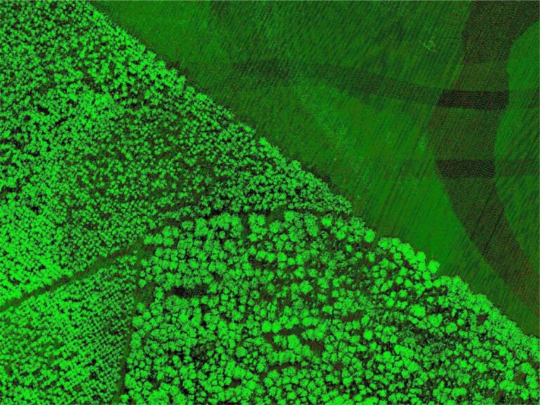
Here, you can quickly start to see the variation in tree size and density across the compartments.
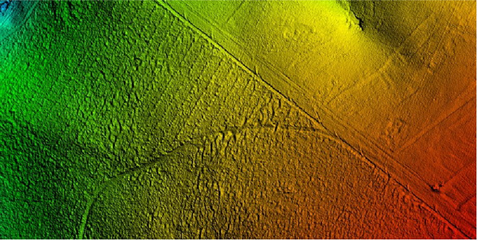
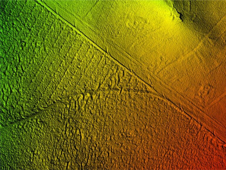
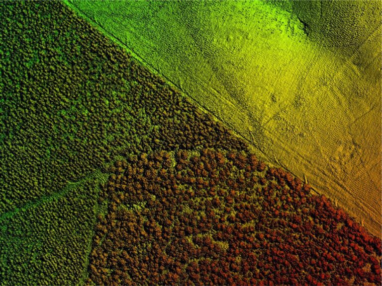
A product of the LiDAR is a very accurate ground-level terrain model even under the trees.
Note how well you can see the drainage furrows along the road and ridging rows under the canopy.
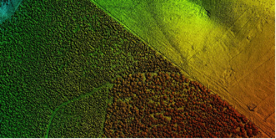
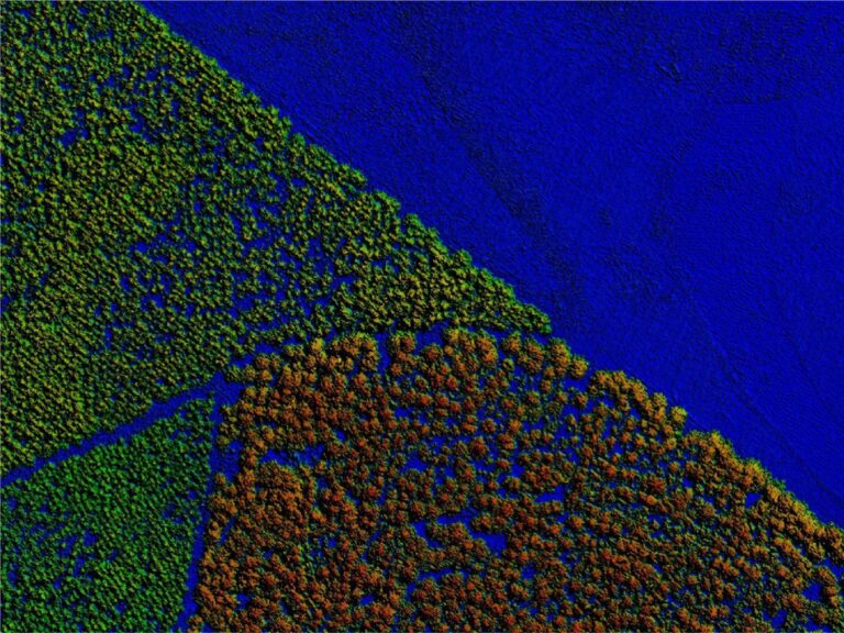
A digital surface model can be created using the tops of the trees. This provides a volumetric description of the vegetation.
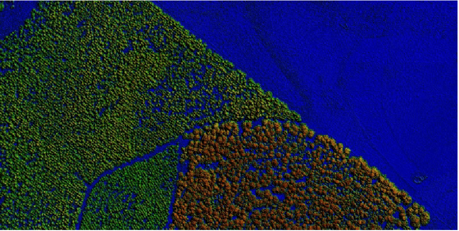
By subtracting the ground model from the digital terrain model, we can derive a canopy height model, which is the height of the trees with ground effects removed.
This provides the actual height of every tree in the compartment.
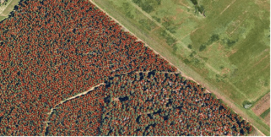
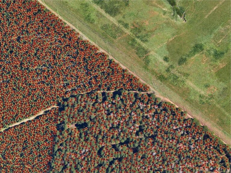
We can identify individual trees by running automated feature recognition on the LiDAR point cloud data.
Each stem gets allocated a point with the tree’s height plus its maximum and average canopy spread.
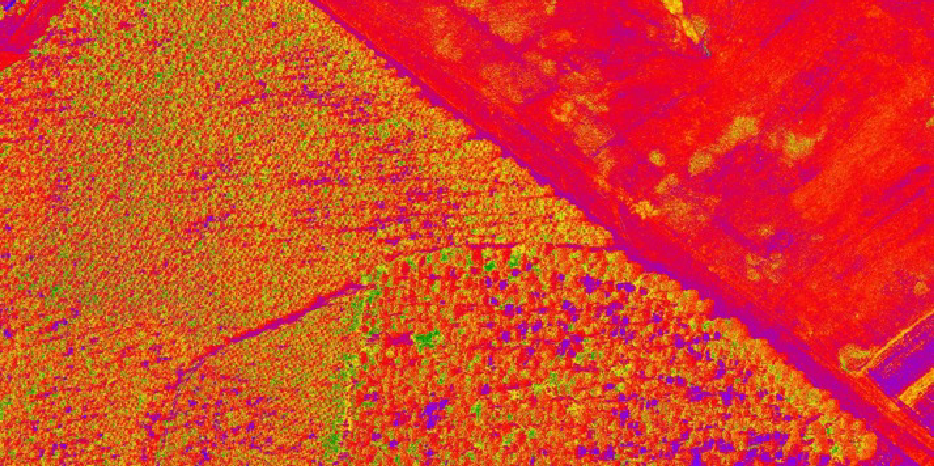
Using multi-spectral images, one can calculate health metrics such as NDVI. Then, by correlating these metrics with the stem data from the LIDAR, one can determine the complete health profile for every tree in the stand.
This information can be invaluable to the forester!
It facilitates accurate enumeration data that accounts for changes in stem density and variations in stem height. Infield problems can be identified, and those trees can be felled early, reducing competition for resources.
