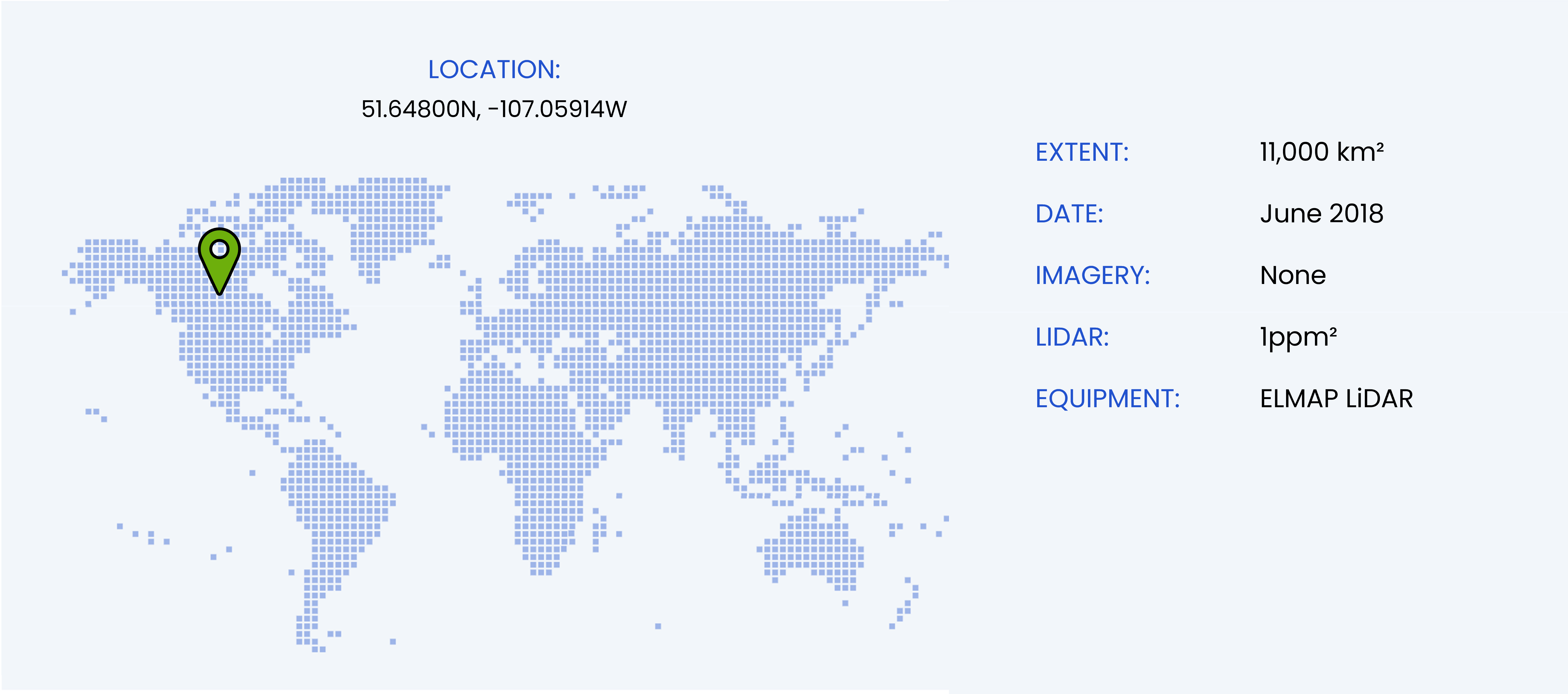
Flood and drainage analysis in Saskatchewan, Canada
OUR LARGEST SURVEY
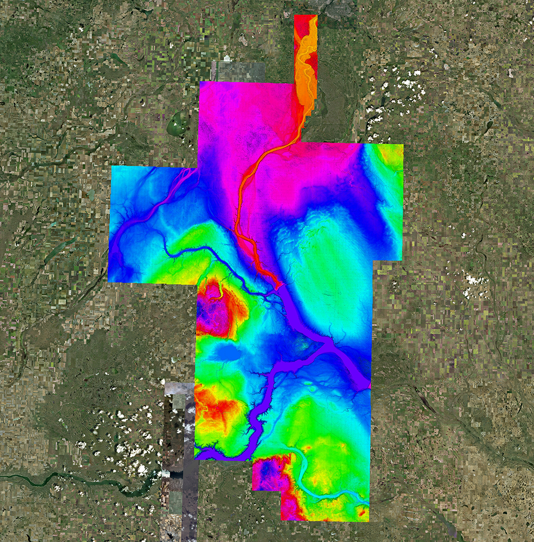
The largest single survey undertaken by WGS occurred over a span of three weeks in the Canadian province of Saskatchewan. This monumental task represented a significant effort to gather extensive data across the vast, flat terrain of the region. However, the project faced numerous challenges, both environmental and operational, that tested the resilience and ingenuity of the team.
BATTLING UNPRECEDENTED WEATHER CONDITIONS
One of the most significant obstacles during the survey was the unpredictable and harsh weather. Strong winds, which could shift direction unpredictably on any given day, made flight planning particularly difficult. Additionally, persistent low cloud cover often obstructed the survey site, preventing clear visibility over critical areas.
To overcome these challenges, the team devised multiple versions of flight lines, allowing them to adapt to varying wind directions. When conditions improved, and the low clouds cleared enough to reveal a sufficient portion of the survey area, the WGS team wasted no time. They were airborne at first light, flying for long, grueling hours across the endless plains of Saskatchewan.
MANAGING OPERATIONS AND EQUIPMENT CHALLENGES
While the environmental challenges were daunting, they were just one part of the equation. The operational demands of the survey also posed significant hurdles. Over the course of the mission, the team captured hundreds of terabytes of data, requiring meticulous processing and analysis once the flights were completed.
The intensive schedule of the operation also took a toll on the aircraft. After accruing extensive flying hours, the aircraft reached its service interval midway through the survey. This required the team to temporarily halt operations, remove and reinstall critical equipment, and complete a 100-hour service before resuming flights.
A TREASURE TROVE OF DATA
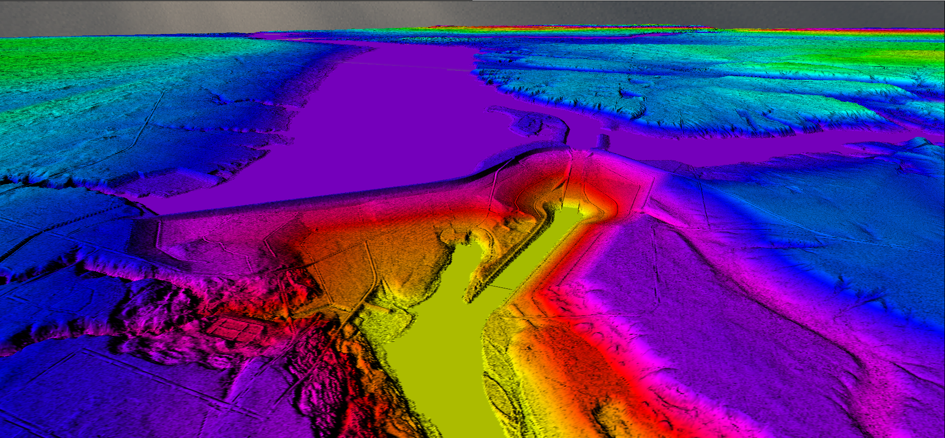
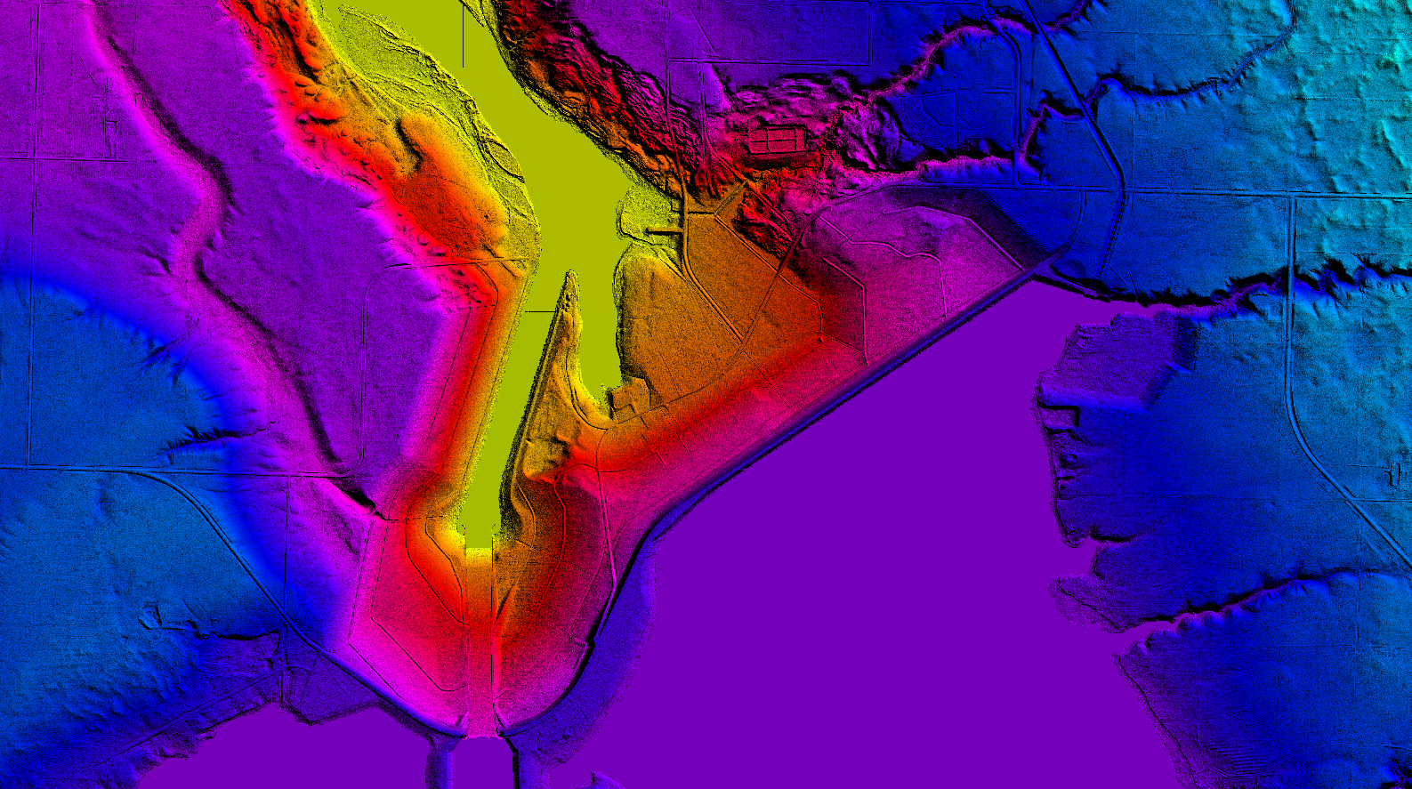
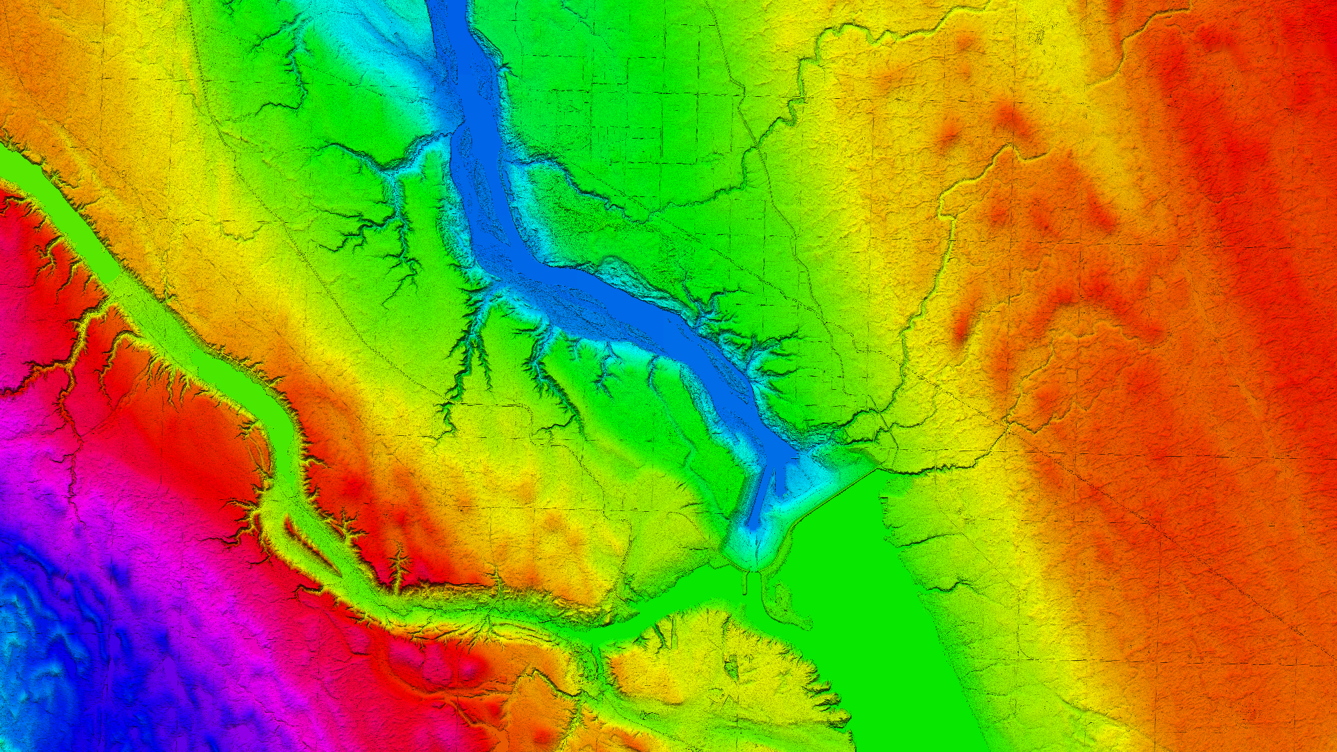
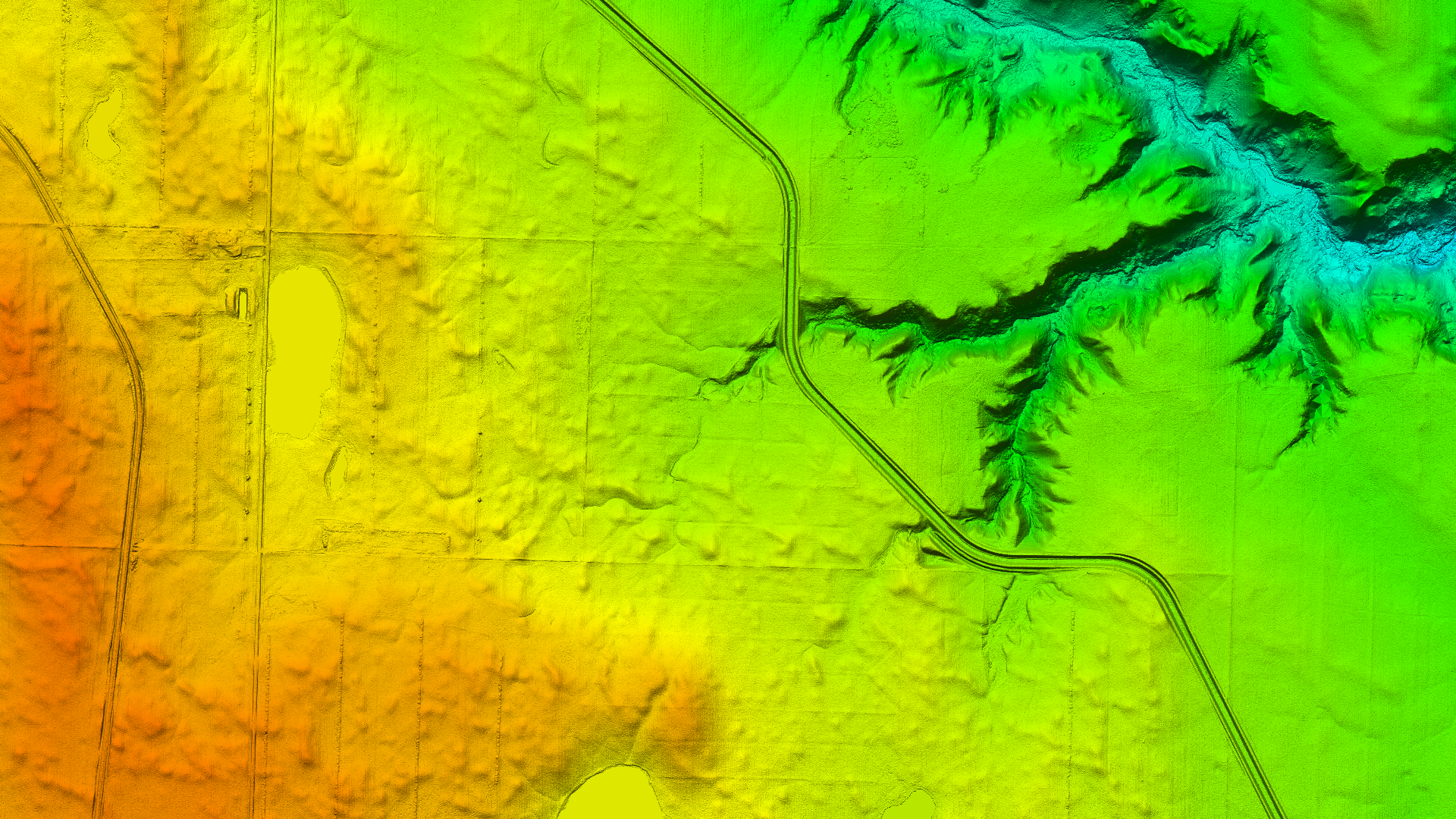
Despite these challenges, the survey yielded groundbreaking results. The data collected during the mission has been instrumental in identifying and analyzing the “prairie potholes” or “kettle ponds” scattered across the Saskatchewan plains. These depressions, formed by retreating glaciers, fill with water outside of winter months.
From an agricultural perspective, prairie potholes present a unique challenge. They render large areas unsuitable for farming unless effective drainage systems are implemented or the depressions are filled in. By mapping their location, size, and volume, the survey data provides a valuable resource for land management and agricultural planning in the region.