Mining

UNLOCKING EFFICIENY AND INSIGHTS FOR MINING OPERATIONS

Maximizing accuracy and productivity in mining with innovative solutions.

ABOUT THE SOLUTION

TRANSFORMING MINING OPERATIONS WITH PRECISION AERIAL SURVEYS

At Wooding Geospatial Solutions, we specialize in delivering precise, actionable aerial survey data for quarries and mining sites. Using state-of-the-art equipment on drones oin manned, fixed-wing aircraft, we offer customised solutions to support every phase of mining, including:

Identify mineral-rich zones and map geological features with high-resolution imagery and data.

Monitor stockpile volumes, track site changes, and ensure compliance with safety and environmental standards.

Enhance productivity through precise terrain mapping, pit optimization, and haul road design.

Assess site conditions, track rehabilitation progress, and document environmental restoration efforts.

Mining Survey Before Image Mining Survey After Image

OUR  SOLUTIONS

TAILORED SOLUTIONS FOR COMPLEX APPLICATIONS

Our aerial and scanning technologies provide mining professionals with precise, cost-effective data to support all stages of operations. We specialize in tailored surveying solutions that streamline decision-making and improve operational efficiency.

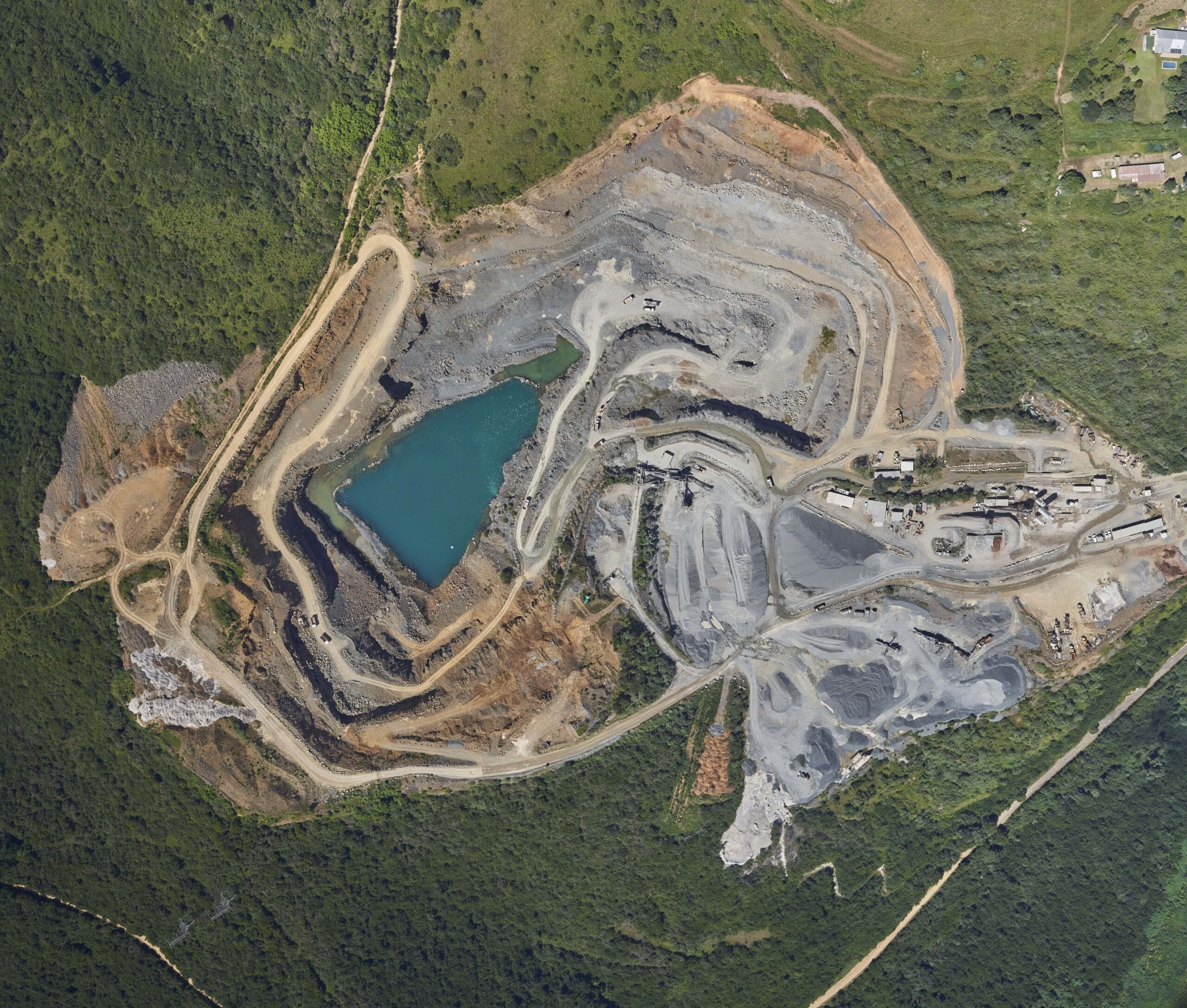
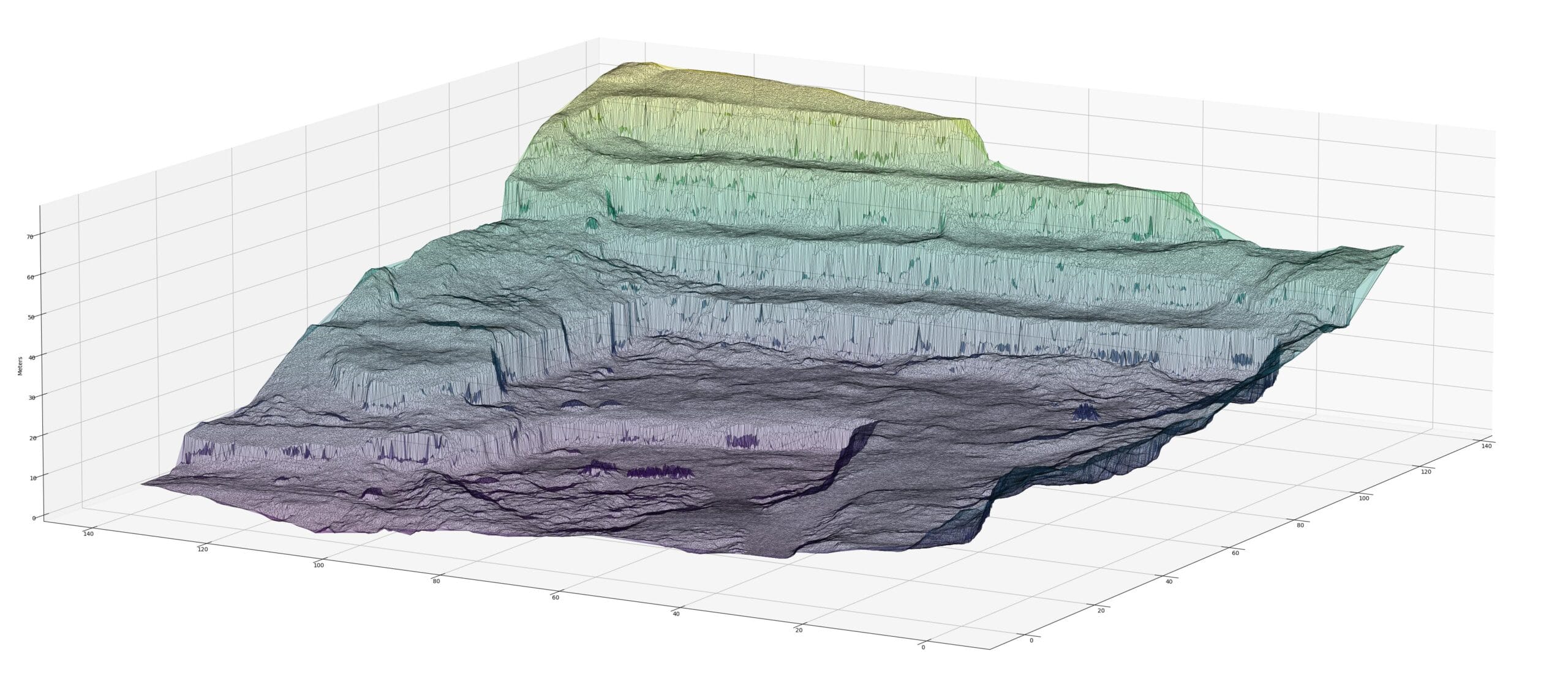
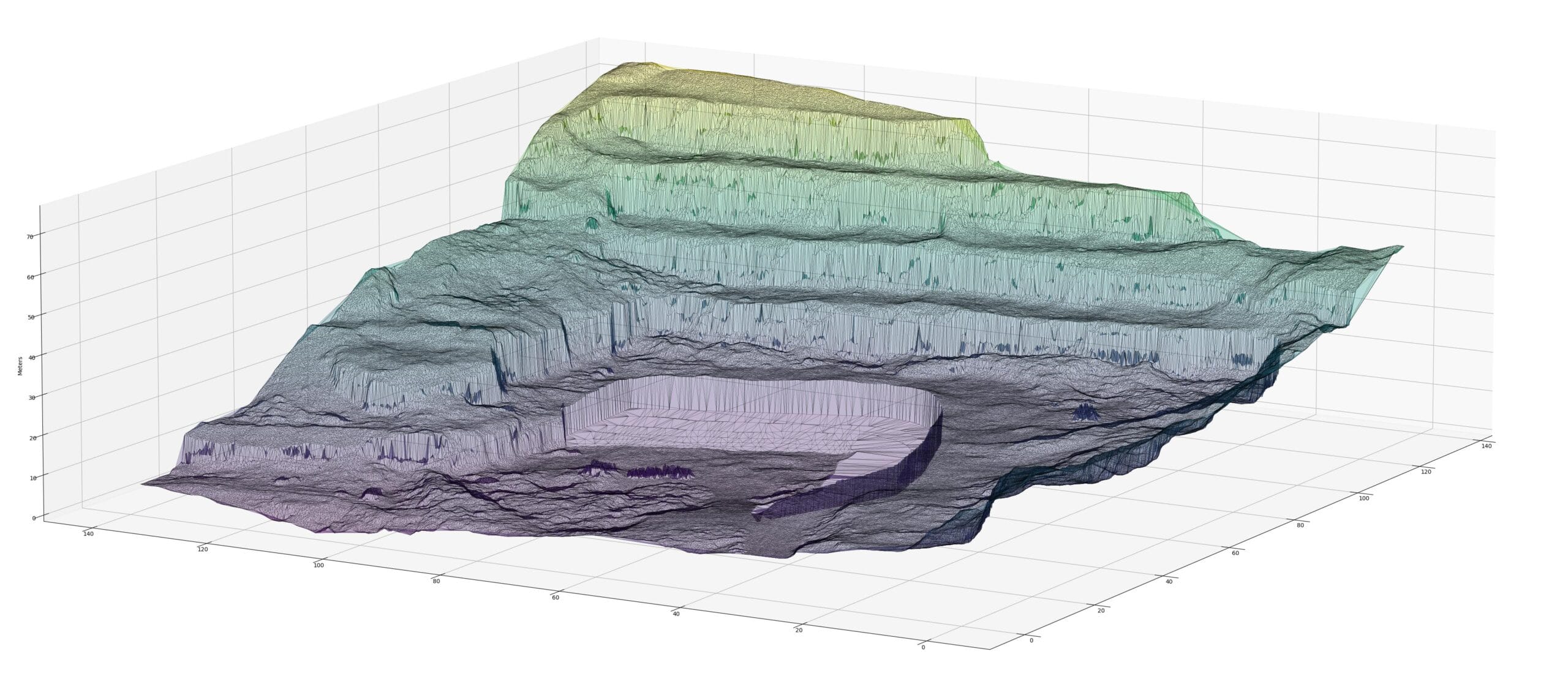
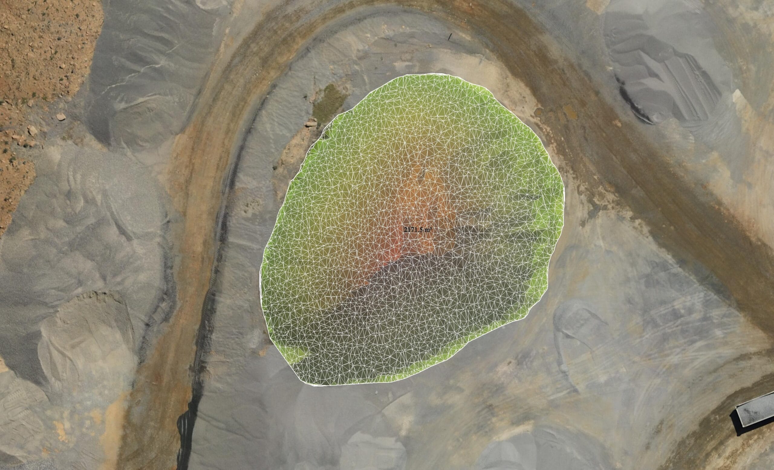
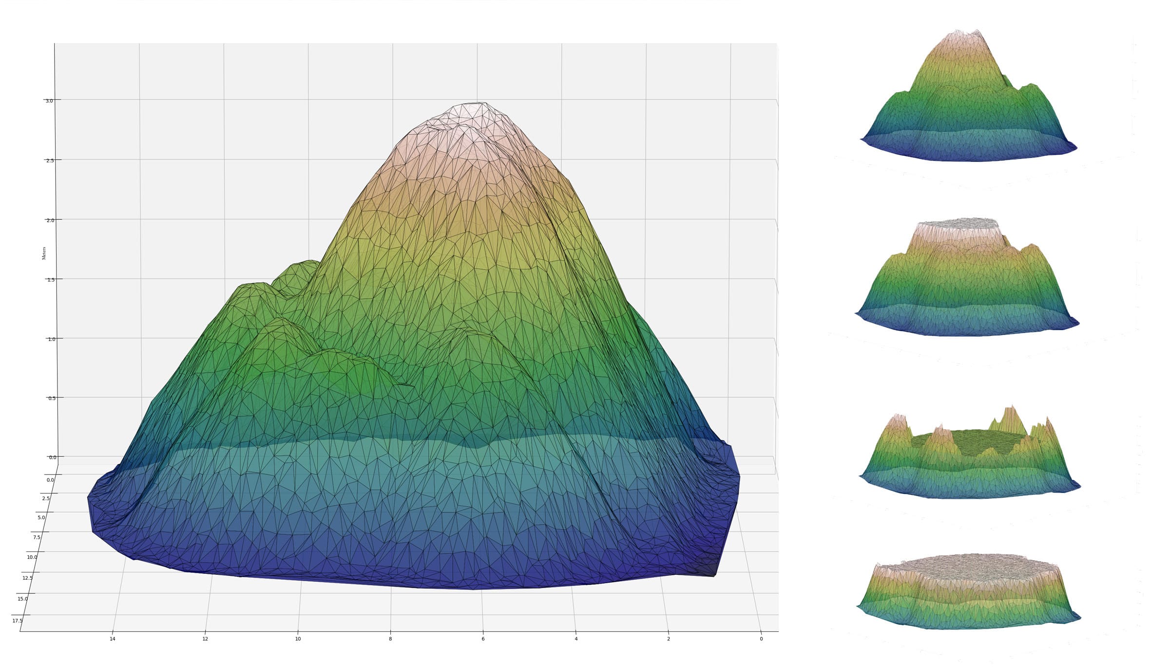
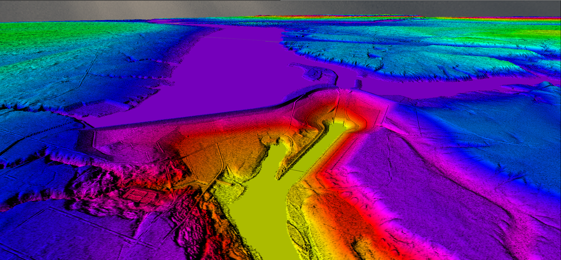
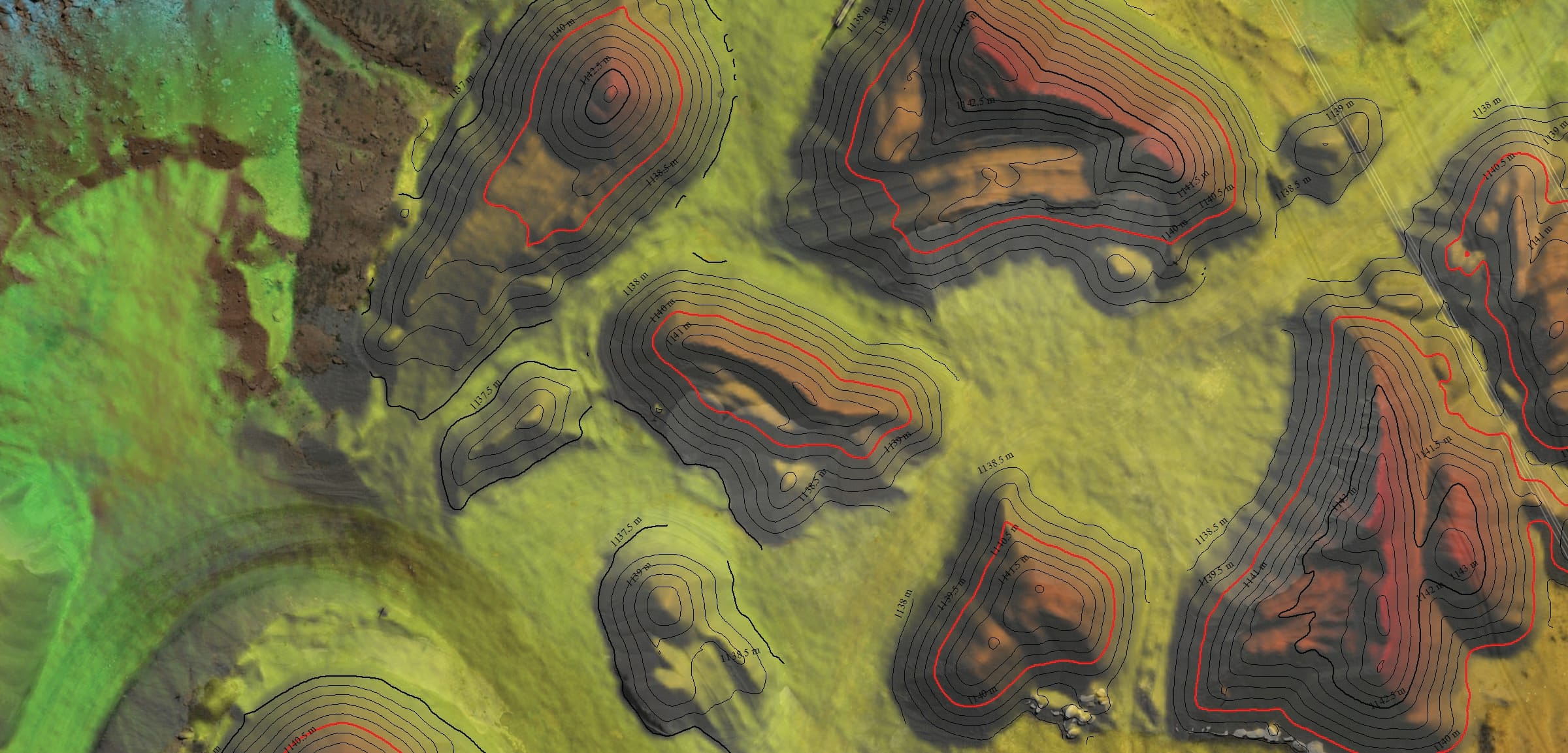
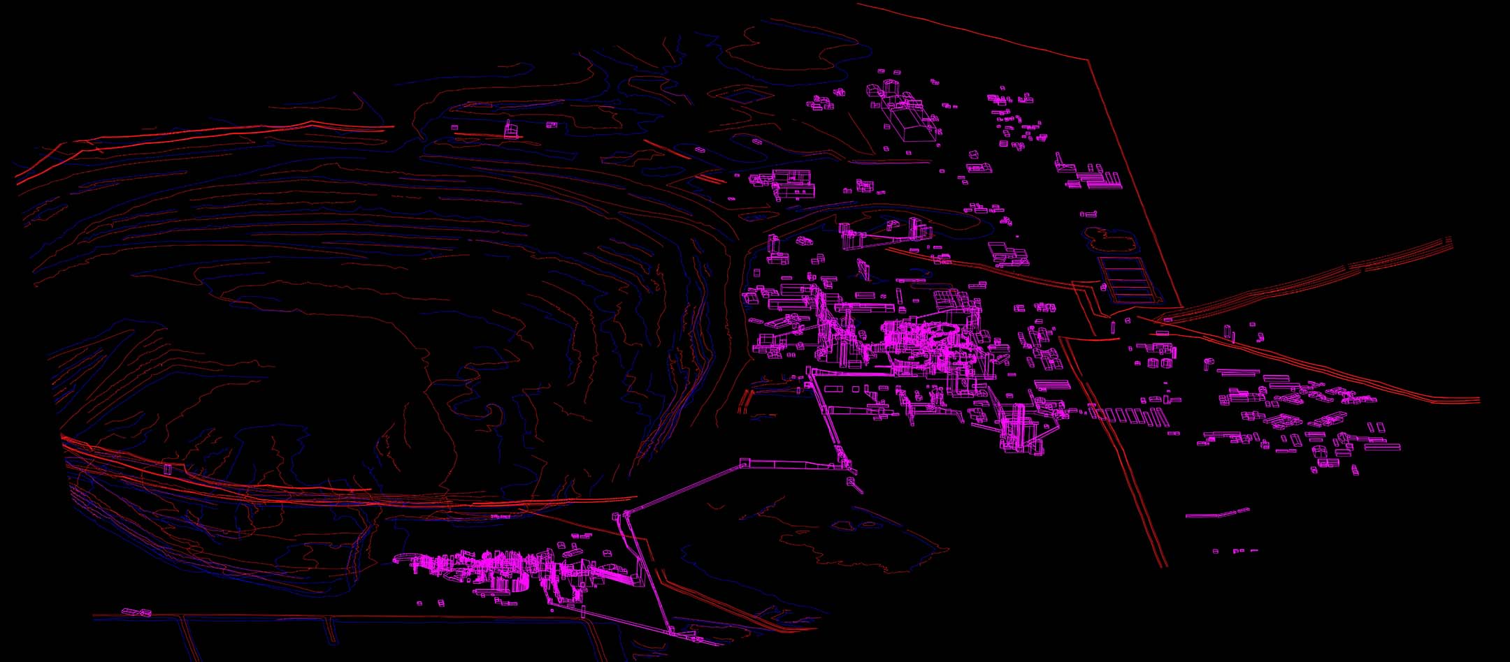
Aerial imagery and LiDAR enable precise volumetric calculations of stockpiles, helping mining and quarry companies track inventory efficiently. This approach saves time compared to manual measurements, reduces errors, and ensures better resource management, leading to improved operational accuracy.

LiDAR provides detailed elevation models that identify hazardous areas such as unstable slopes, waterlogging, or erosion zones. By replacing physical inspections in dangerous locations with remote sensing, companies can enhance worker safety and minimize risks in challenging environments.

Orthophotos and LiDAR data support pit design, haul road optimization, and infrastructure placement by delivering high-accuracy terrain and topographic models. This ensures efficient operational planning, reduces costs, and maintains compliance with engineering and safety standards.

LiDAR and aerial imagery are crucial for tracking land use changes, vegetation growth, and environmental restoration efforts. By ensuring adherence to environmental regulations, companies can demonstrate sustainability efforts and avoid penalties, contributing to a positive environmental impact.

Frequent aerial surveys capture progress and detect changes in terrain or infrastructure, enabling real-time decision-making. This minimizes project delays, ensures operations remain on schedule, and allows for better resource allocation during dynamic mining activities.

SURVEY SOLUTIONS TAILORED TO YOUR NEEDS

LIDAR AND AERIAL IMAGERY SOLUTIONS FOR SMARTER MINING MANAGEMENT

Leverage the power of LiDAR and aerial imagery to revolutionize your mining and quarry operations. From precise volumetric measurements to detailed terrain mapping, our solutions deliver actionable insights for enhanced efficiency and safety.

WHY CHOOSE US?

COUNTLESS SURVEY CAPABILITIES

Decades of expertise working with leading mining companies globally.

From data acquisition to advanced analytics, we deliver end-to-end services.

Cutting-edge drones, fixed-wing aircraft, and 3D scanning tools ensure exceptional accuracy.

Tailored solutions to fit your project’s budget and requirements.

HOW IT WORKS

OUR SIMPLE, EFFICIENT SURVEY PROCESS

1
Consultation and Planning
- We discuss your project goals, site specifics, and required deliverables.
- Our team designs a tailored survey plan, including flight paths, data collection methods, and timelines.
2
Data Acquisition
- Using either drones or fixed-wing aircraft, we capture high-resolution LiDAR and imagery data.
- Surveys are conducted efficiently and safely, minimizing disruption to site operations.
3
Data Processing and Analysis
- Our experts process the collected data into actionable insights, including detailed topographic maps, 3D models, and volumetric measurements.
- We ensure data accuracy and compliance with industry standards.
4
Delivery and Support
- Deliverables are provided in client-preferred formats, along with metadata, methodology statements and quality control reports.
- We offer free support and post-survey consultation to integrate the data into your operational workflows.

FREQUENTLY ASKED QUESTIONS

The accuracy will be discussed during the planning stage and depends on the project requirements and budget. Anything from 20-100mm would be a normal range.

Aerial surveys focus on surface data. While they can identify geological features and terrain variations, underground resource detection typically require alternative methods.

The timeline depends on the size and complexity of the site as well as it’s location. It generally takes longer to get permits for remote locations and large, complex projects may take days to acquire and weeks to process. Conversely, monitoring and volumes surveys are typically turned around in less than 24hours.

Since the products and accuracies are similar for both methodologies, the decision factors are size and remoteness of the area. Large projects take multiple flights to acquire using a drone which could be completed very quickly by manned aircraft. Sites that are far away or difficult to access are also generally better suited to manned aircraft.

Yes, WGS is a Civil Aviation Authority-approved operator and holds all required insurances and approvals. If clients have specific approval requirements, our company can quickly obtain the necessary compliance.

DELIVERING HIGH-QUALITY AERIAL SURVEYS WHEREVER YOU NEED

GLOBAL REACH, LOCAL PRECISION

Our services are available worldwide. Whether your project is in remote areas, across challenging terrain, or in urban landscapes, our team can deploy an equipped aircraft to capture precise data wherever you need it. 

With operational capabilities spanning continents, we bring advanced geospatial solutions directly to your location, ensuring that distance and geography are never barriers to high-quality aerial data. 

UNITED KINGDOM 

31 Smithbrook Kilns,

Cranleigh, Surrey, GU6 8JJ

Tel: +44 (0)1483 347 755

SOUTH AFRICA

#203, Worlds View Office Park,

Worlds View Drive, Gillitts, 3610

Tel: +27 (0)31 765 1424

CANADA

#300 – 340 Midpark Way S.E.

Calgary, AB, T2X 1P1

Tel: +1 (403) 383 5305

NEW ZEALAND 

32 Hopkins Road,

Mata Mata, 3472

Tel: +64 (0) 27 227 9304

WHO WE’VE HELPED

YOU’RE IN GOOD COMPANY

We are continuously engaged in fascinating projects with inspirational clients!

"Wooding Geospatial Solutions have come up with an effective solution to the problem we were faced with. Thank you and we are looking forward to working with this team on our next project!"
Scott V.
"The service was excellent. The survey that Wooding Geospatial Solutions did for us was handled efficiently and professionally. We were very happy with the reports. Highly recommended!"
James S.
"We received the data, and are extremely happy with it. From the quality of the imagery to the extent of the final deliverables, it’s easily one of the best Orthophotography projects we’ve been involved in."
Rob M. - Vermillion County
"The LiDAR data has been a HUGE help, not only for drill planning but we have also been able to find a bunch of new outcrops now have been in the forest."
Pete S. - Virginia Mining Corporation
"Wooding Geospatial Solutions is a professional organisation and all work has been delivered timeously and to specification."
Patrick G. - GeodesyGroup Inc.

READY TO OPTIMISE YOUR MINING OR QUARRYING OPERATIONS?

Let us help you with cutting-edge aerial survey services designed to deliver reliable results.