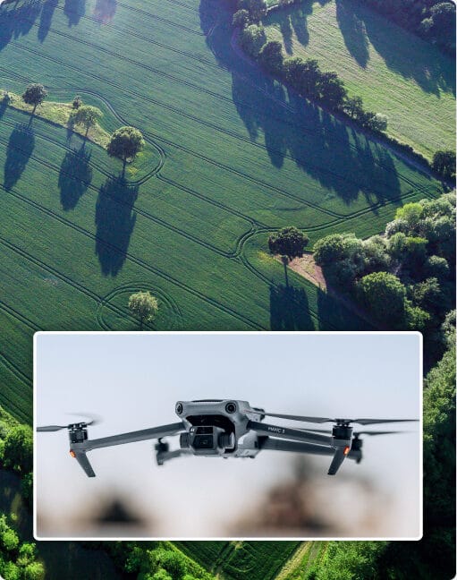
Our expert drone services deliver precise and reliable data for inspections and high-accuracy mapping, tailored to meet your specific needs. Leveraging cutting-edge technology, we provide efficient, safe, and cost-effective solutions across a wide range of industries. Whether it’s capturing detailed imagery or performing comprehensive inspections, our drones are equipped to handle it all.
High-Resolution Mapping: Generate detailed orthophotos, 3D models, and terrain maps with centimeter-level accuracy.
Efficient Inspections: Conduct visual and thermal inspections safely in hard-to-reach areas, minimizing downtime.
Customized Solutions: Tailored services for construction, agriculture, utilities, and more, ensuring actionable insights.
Our drone inspection services provide an efficient, safe, and cost-effective solution for inspecting critical infrastructure and assets. By using high-resolution imaging, thermal sensors, and advanced data processing, we deliver comprehensive insights that help you manage assets more effectively while minimizing downtime and risk.
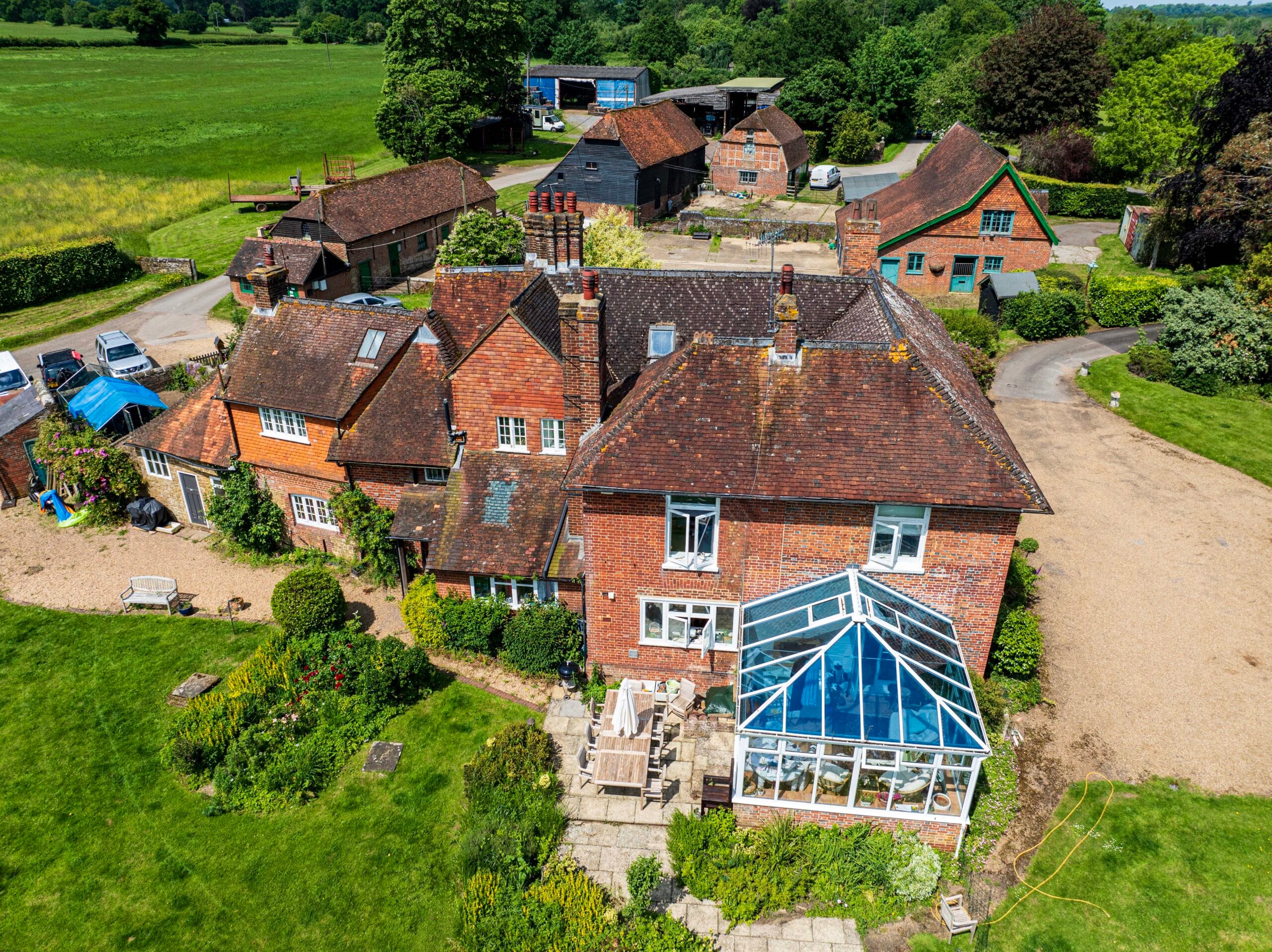
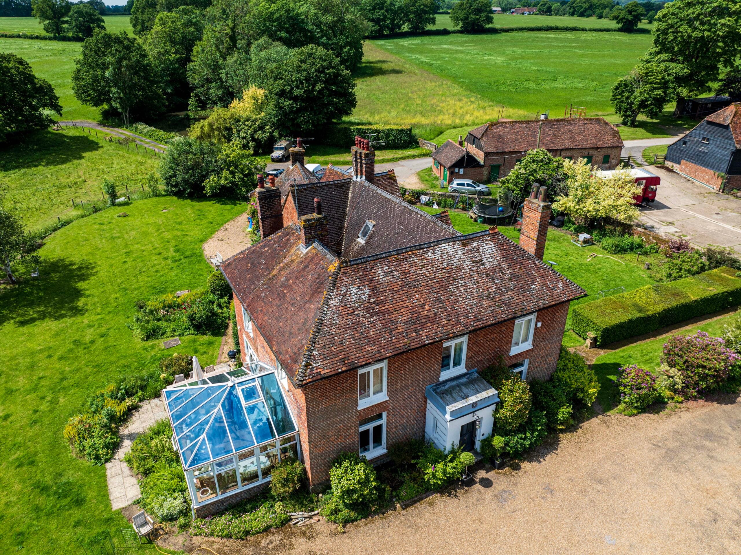
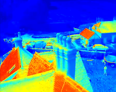
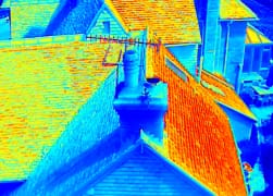
Conduct detailed roof inspections to assess damage, detect leaks, and identify areas needing maintenance. All without the need for scaffolding or ladders.
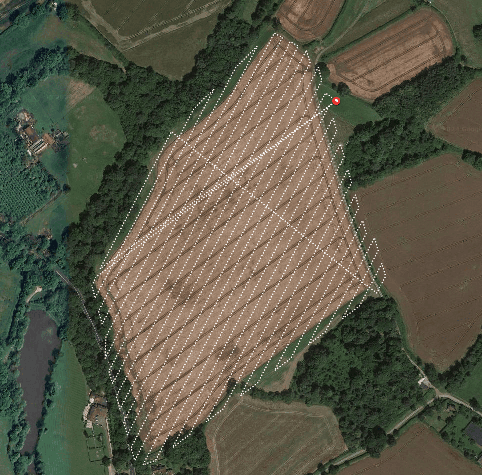
Conduct detailed property surveys to assess land features and boundaries without traditional equipment. Drones provide efficient, high-resolution imagery for development and environmental assessments. See more info here.
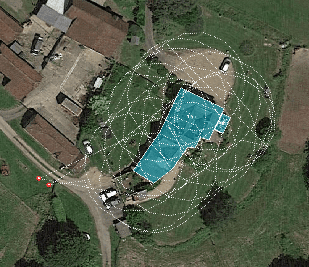
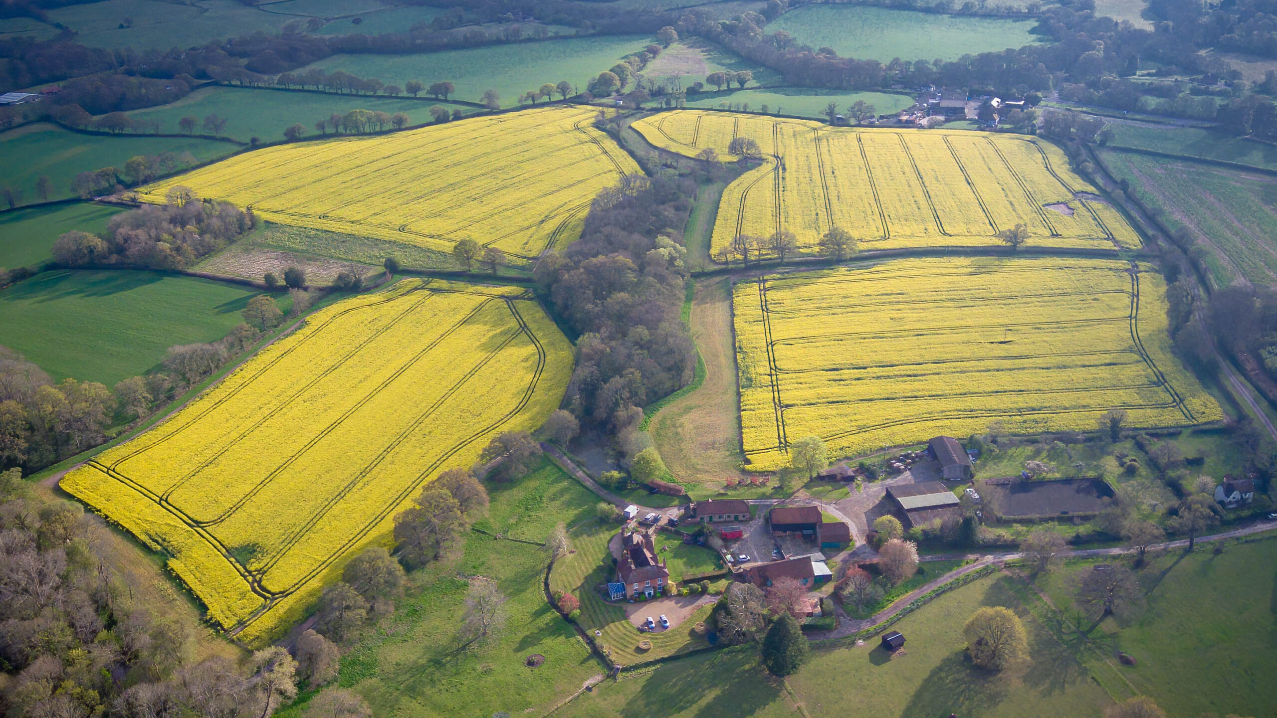
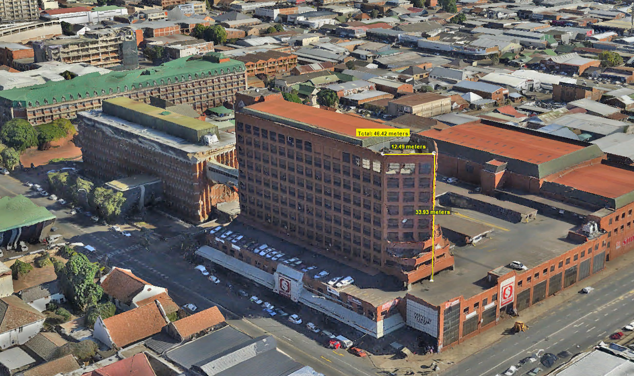
ORTHOPHOTO MAPPING WITH UAV TECHNOLOGY
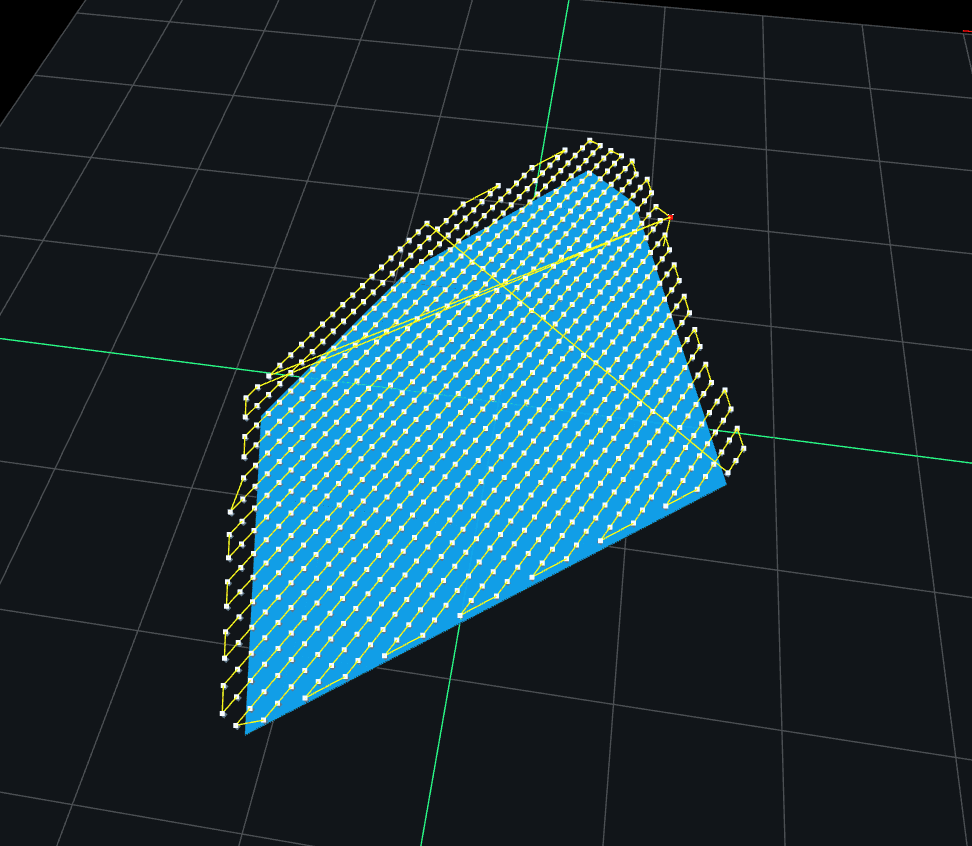
Orthophoto mapping with UAVs delivers unparalleled accuracy and precision, providing high-resolution, distortion-free imagery. Our advanced drones ensure every detail is captured, enabling precise measurements and reliable data for critical applications. From land planning to infrastructure development, UAV orthophotos set the standard for detailed and dependable mapping solutions.
Ideal for applications requiring consistent, distortion-free mapping data.
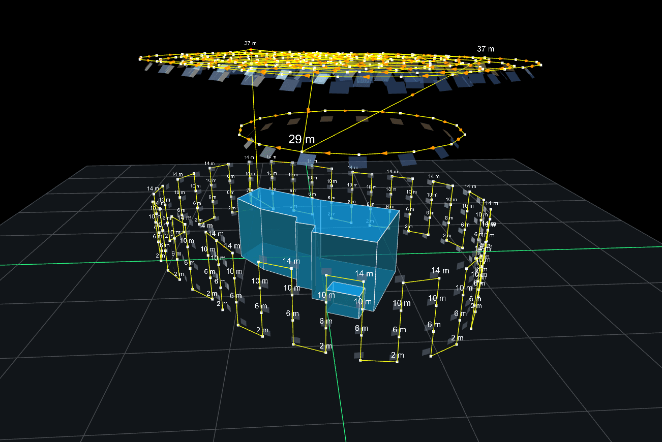
OUR EQUIPMENT
Our drone inspection equipment integrates cutting-edge technology to deliver optimal solutions for survey projects. High-resolution cameras, LiDAR sensors, GPS modules, and thermal imaging tools are carefully combined to capture precise and detailed data over large areas. Advanced software processes this data into actionable insights, including 3D maps, orthomosaics, and terrain models. This synergy of hardware and software allows drones to perform tasks more efficiently and cost-effectively than traditional methods.
Our drone inspections go beyond simple image capture. We utilize specialized cameras, including thermal and multispectral, to collect detailed data on asset condition. Additionally, our post-processing services transform raw data into actionable insights, allowing you to make informed decisions quickly.
High-Resolution Imaging
Capture fine details that are crucial for detecting small faults and damages.
Thermal Imaging
Identify issues like heat loss, water ingress, and material defects with thermal cameras.
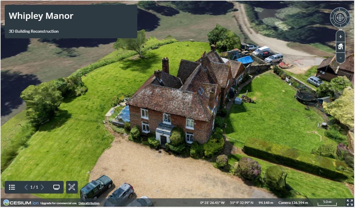
3D Modelling and Mapping
Create accurate 3D models and maps for structural analysis, terrain mapping, and asset visualization.
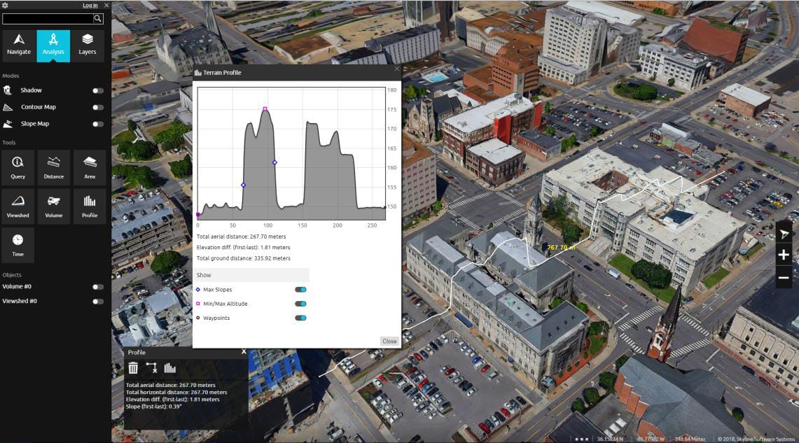
Data Analysis and Reporting
Receive clear, detailed reports with annotated imagery, measurements, and analysis.
APPLICATIONS
SERVING A WIDE RANGE OF INDUSTRIES
Our drone inspection services support industries where safety, accuracy, and efficiency are paramount. From energy and telecommunications to construction and environmental management, we provide data solutions that help optimize maintenance, monitor compliance, and drive strategic decision-making.
We start with a detailed consltation to understand your specific needs and project requirements, ensuring we tailor our imaging solution to your objectives.
2
Data Capture
Our experienced team uses large-format mapping cameras mounted on manned aircraft to capture data with pinpoint accuracy and wide coverage.
3
Data Processing and Delivery
After capturing the data, our team processes it for seamless integration into your workflows, providing high-quality deliverables ready for analysis.
PRECISION DATA COLLECTION FROM OUR STRATEGIC BASES
DRONE IMAGING COVERAGE
From our worldwide strategic bases, we provide drone imaging services to clients worldwide. From urban centers to remote landscapes, our team has the capacity to capture high-resolution data wherever your project is located.
We are continuously engaged in fascinating projects with inspirational clients!
"Wooding Geospatial Solutions have come up with an effective solution to the problem we were faced with. Thank you and we are looking forward to working with this team on our next project!"
Scott V.
"The service was excellent. The survey that Wooding Geospatial Solutions did for us was handled efficiently and professionally. We were very happy with the reports. Highly recommended!"
James S.
"We received the data, and are extremely happy with it. From the quality of the imagery to the extent of the final deliverables, it’s easily one of the best Orthophotography projects we’ve been involved in."
Rob M. - Vermillion County
"The LiDAR data has been a HUGE help, not only for drill planning but we have also been able to find a bunch of new outcrops now have been in the forest."
Pete S. - Virginia Mining Corporation
"Wooding Geospatial Solutions is a professional organisation and all work has been delivered timeously and to specification."
Patrick G. - GeodesyGroup Inc.
DISCOVER THE POWER OF PRECISION DRONE INSPECTIONS
Our team is ready to provide detailed, actionable data for your inspection needs. Contact us today to learn more about how our drone inspection services can support your project.