Wind Farm Mapping
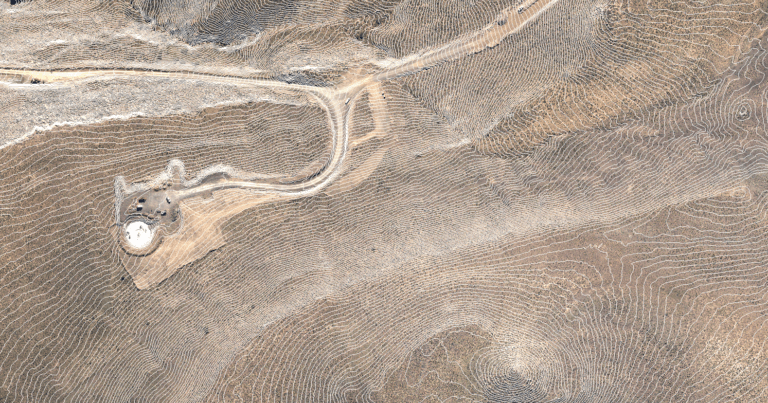
Comprehensive Topographical Data for Wind Farm Planning Effective wind farm planning hinges on high-quality topographical data, essential for the precise positioning of turbines and the strategic planning of access roads,
Comprehensive Topographical Data for Wind Farm Planning Effective wind farm planning hinges on high-quality topographical data, essential for the precise positioning of turbines and the strategic planning of access roads,
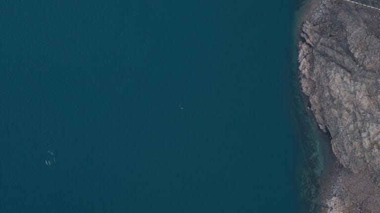
AERIAL SURVEYS FOR MARINE WILDLIFE COUNTING WHALES FROM ABOVE The Role of Wildlife Surveys in Conservation Wildlife surveys play a crucial role in understanding biodiversity health and supporting effective ecological
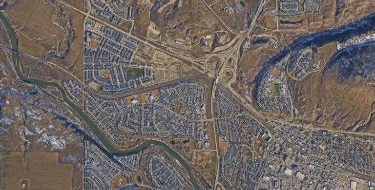
Urban LiDAR Survey in Alberta We recently completed a comprehensive aerial LiDAR survey of a large town in Alberta, delivering exceptional results beyond the original project specifications. While the client
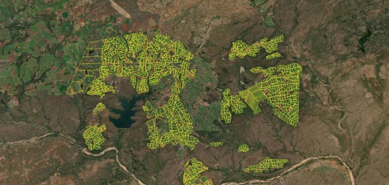
Southern Africa Sugar Crop Area Audit ZIMBABWE, SOUTH AFRICA, MOZAMBIQUE Leveraging Satellite Data for Agricultural Analysis Satellite sensors provide a wealth of coarse image data, extending beyond standard RGB imagery
Multi Spectral Imaging of Industrial effluent PIETERMARITZBURG, SOUTH AFRICA Modular Sensor Integration for Maximum Efficiency WGS employs a modular system design that allows the seamless integration of multiple sensors to

Oblique Acquisition and 3D City Modelling PIETERMARITZBURG, SOUTH AFRICA Advanced Multi-camera Imaging System WGS has developed a purpose-built oblique imaging multicamera rig that sets a new standard in geospatial data
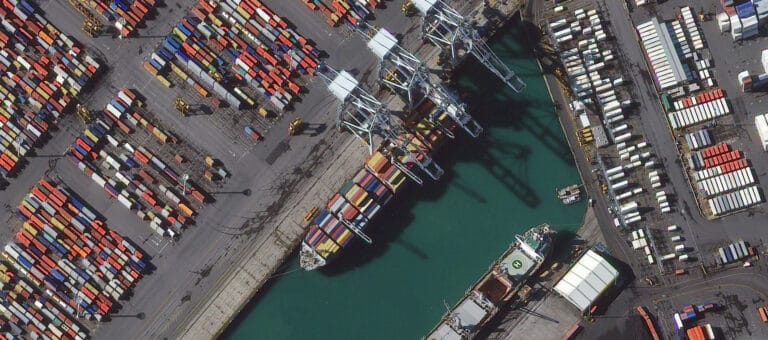
UAV PORT TERMINAL SURVEY MANILA, PHILLIPINES ADVANCEMENTS IN DRONE TECHNOLOGY Unmanned Aerial Vehicle (UAV) surveys, more commonly known as Drone surveys have become a reliable solution for photogrammetric surveys, thanks
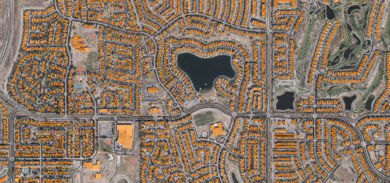
TOWN MAPPING AND URBAN PLANNING IN ALBERTA, CANADA SUPPORTING SMALL COMMUNITIES ACROSS CANADA WGS provides critical geospatial services to numerous smaller towns and hamlets annually during the Canadian season. These

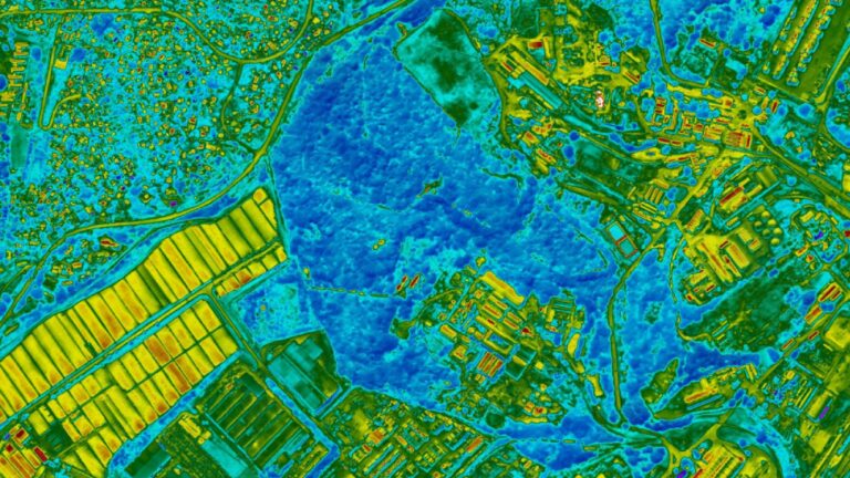
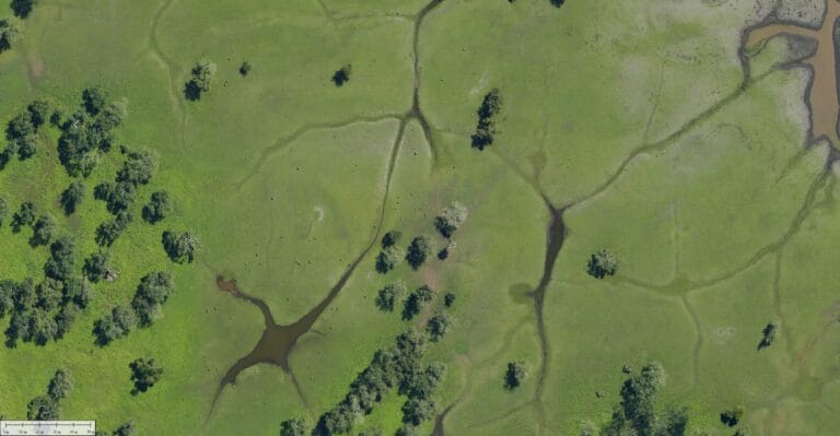
Flood and drainage analysis in Saskatchewan, Canada OUR LARGEST SURVEY The largest single survey undertaken by WGS occurred over a span of three weeks in the Canadian province of Saskatchewan.

Introduction Drone technology has transformed inspection and survey processes across various industries, offering enhanced efficiency, safety, and cost-effectiveness. From construction sites to energy facilities, drones provide unparalleled access and data
Introduction Aerial surveys play a vital role across industries, including agriculture, land development, ecological studies, and urban planning. Traditionally, either drones or dedicated survey aircraft performed these surveys, but both
Project Overview The Princeton University team embarked on a challenging LiDAR survey over Gorongosa National Park. Due to unpredictable environmental factors, including wildfires from a lingering drought, the project required
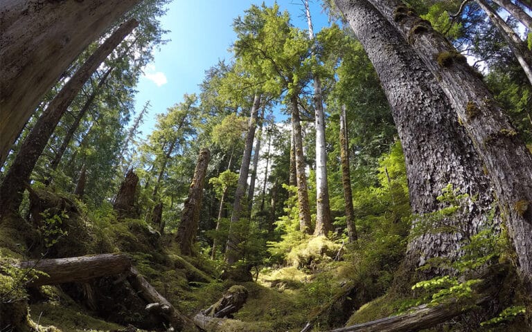
Introduction to the Gwaai Haanas LiDAR Project In 2018, WGS launched a LiDAR survey on Moresby Island, focusing on Gwaai Haanas National Park, located off the West Coast of British