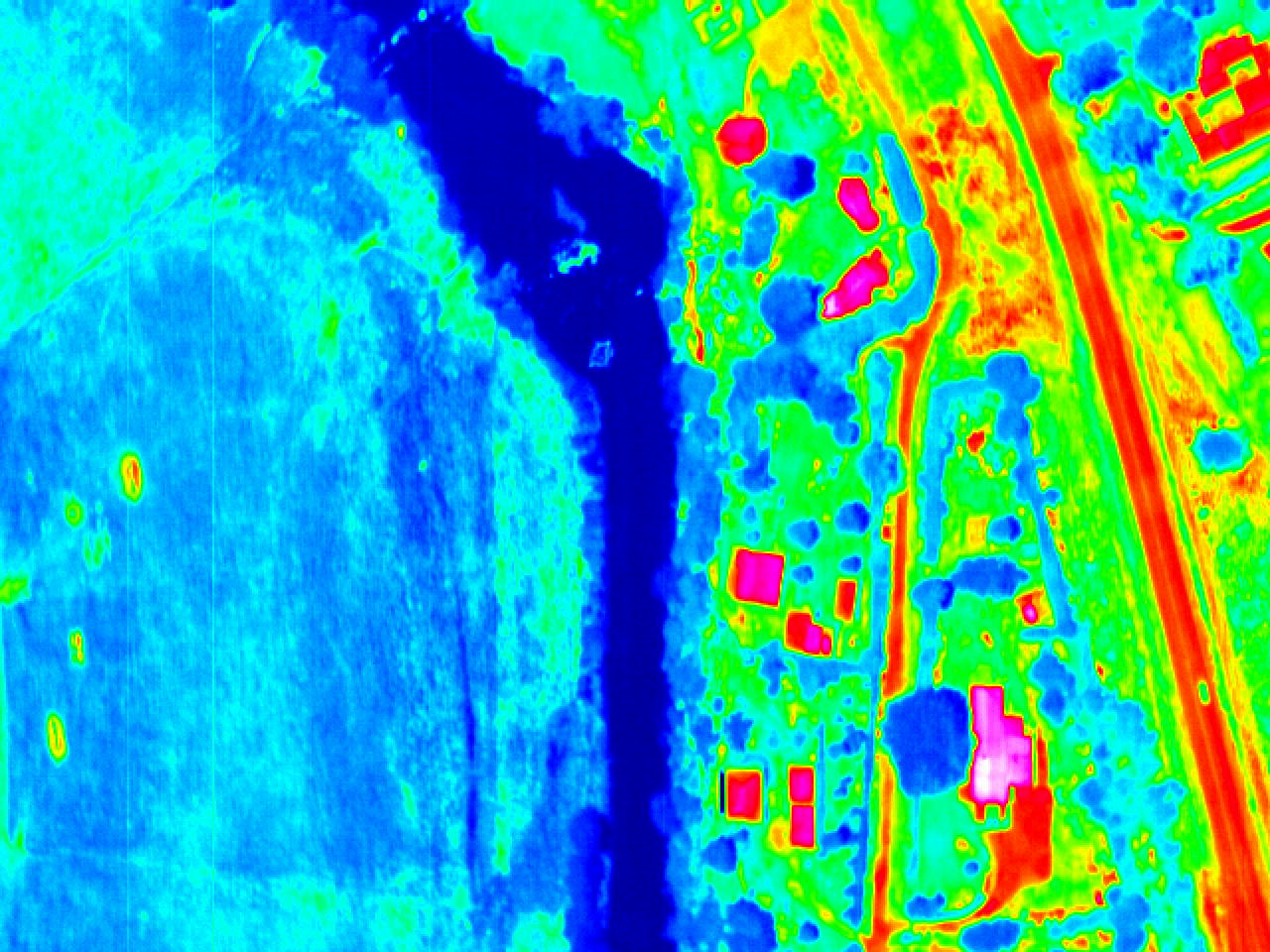
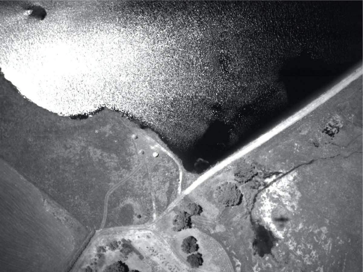
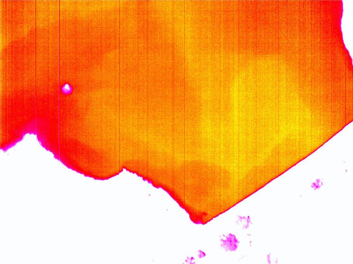
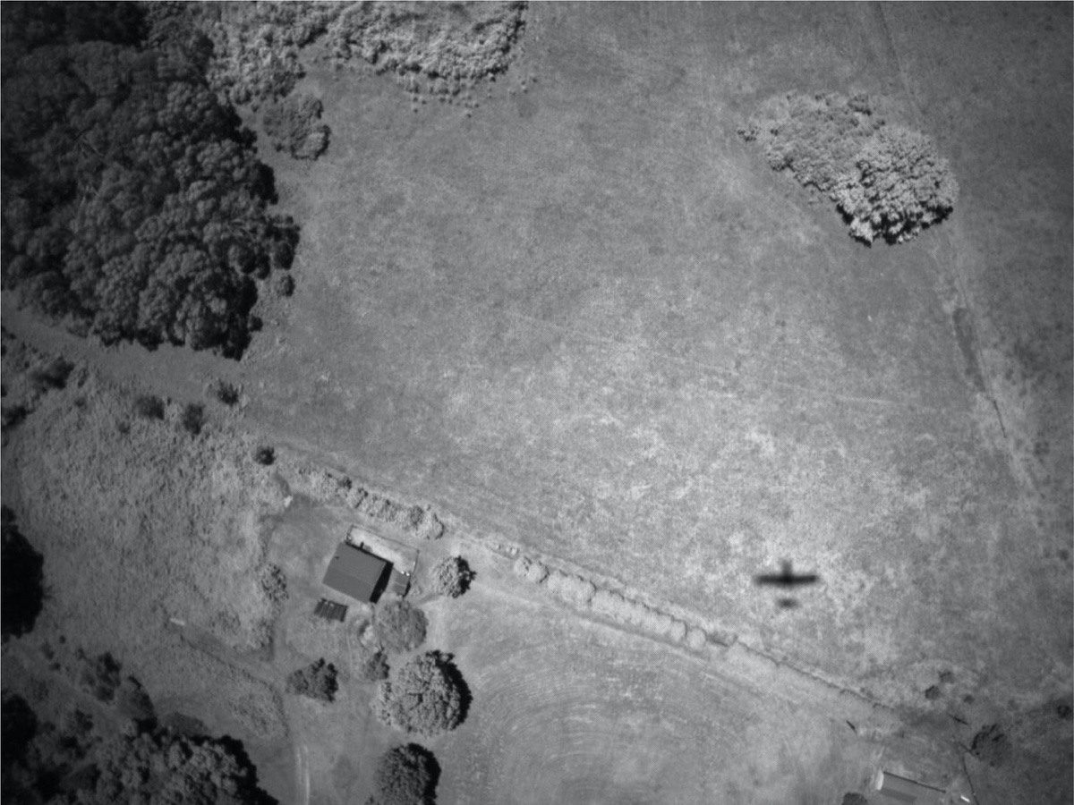
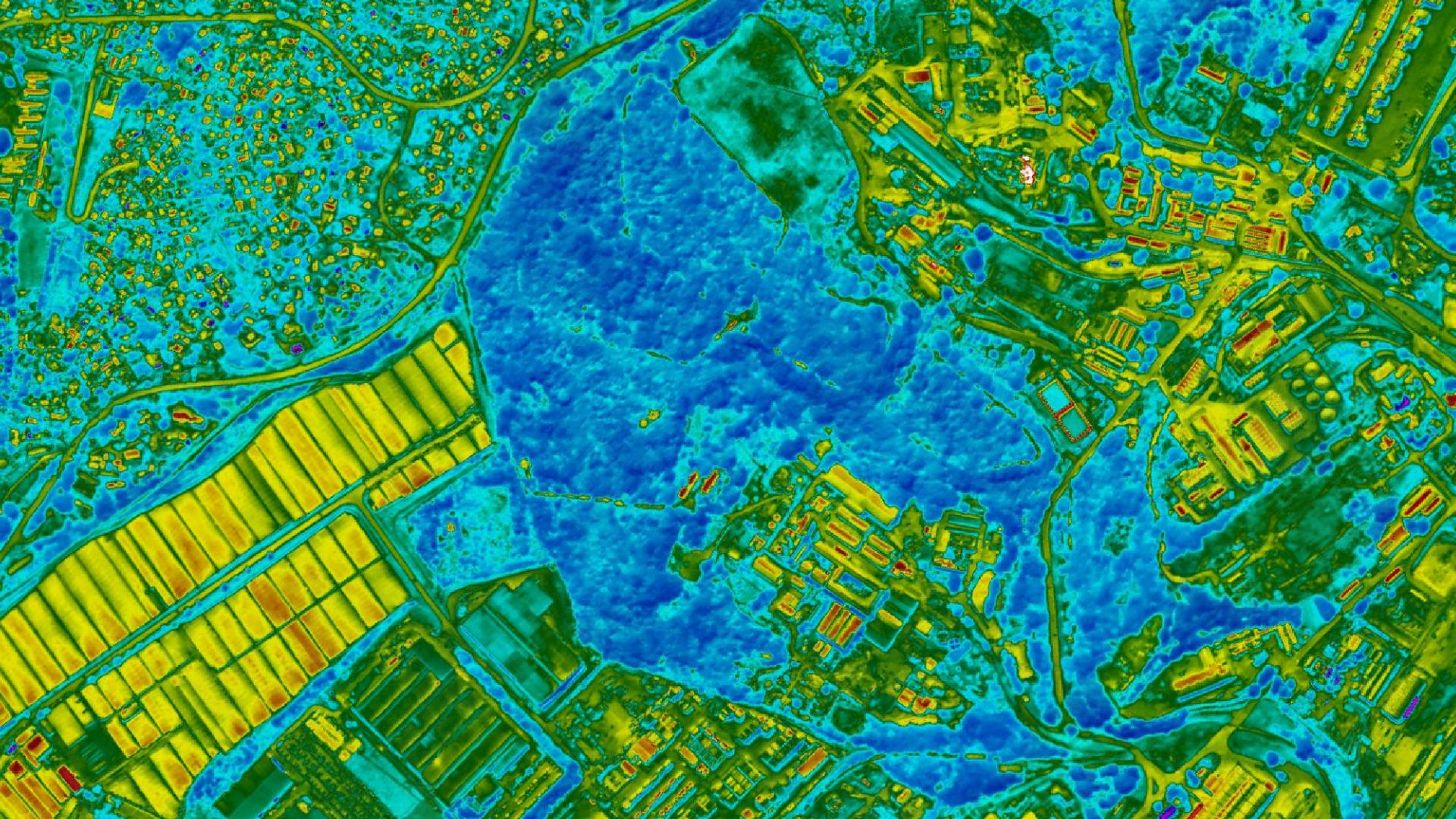
WGS uses thermal surveys for fire mapping, vegetation health assessments and heat loss assessments. With an accuracy of less than a degree, even small changes can be detected.
For fire mapping, both above ground and subterranean fires can be monitored as well as the heat from stockpiles and mine dumps.
Thermal imaging is simply the process of converting infrared (IR) radiation (heat) into visible images that depict the spatial distribution of temperature differences in a scene viewed by a thermal camera.
Professional-grade thermal imaging cameras for superior picture quality.
Ideal for complex, large-scale projects requiring precise data.
Efficient data capture across challenging terrains and expansive coverage areas.
ACCURACY AND SCALE WITHOUT COMPROMISE
Our thermal imaging solutions provide unparalleled accuracy and scale, capturing data over extensive areas in a fraction of the time needed by other methods. With state-of-the-art thermal survey cameras mounted on manned aircraft, we deliver consistent, high-quality data for every project.
Professional-grade equipment ensures stable, high-quality output under various conditions.
SURVEY SOLUTIONS TAILORED TO YOUR NEEDS
COMPREHENSIVE THERMAL SURVEY CAPABILITIES
Geo-referenced aerial images with precise spatial accuracy for mapping and planning. High-Resolution DTM (Digital Terrain Models). Detailed topography data for land use planning and engineering. 3D Urban Modelling: Accurate 3D representations of urban areas for city planning and smart city projects.
OUR THERMAL SURVEY PROCESS
3-STEP PROCESS VISUALISATION:
1
Project Consultation
We start with a detailed consltation to understand your specific needs and project requirements, ensuring we tailor our imaging solution to your objectives.
2
Data Capture
Our experienced team uses large-format mapping cameras mounted on manned aircraft to capture data with pinpoint accuracy and wide coverage.
3
Data Processing and Delivery
After capturing the data, our team processes it for seamless integration into your workflows, providing high-quality deliverables ready for analysis.
Aerial thermal mapping uses drones or aircraft equipped with thermal cameras to capture infrared radiation. These cameras detect temperature variations on the surface and convert them into thermal images or maps.
Accuracy depends on factors like camera resolution, environmental conditions, and altitude. High-quality thermal sensors can detect temperature differences as small as ±0.1°C, offering precise insights.
Yes, thermal mapping is highly effective at night because the absence of sunlight reduces interference from reflective surfaces, enhancing the clarity of temperature data.
Click here to view the full range of our services.
PRECISION DATA COLLECTION FROM OUR STRATEGIC BASES
THERMAL SURVEY COVERAGE
From our worldwide strategic bases, we provide aerial imaging services to clients worldwide. From urban centers to remote landscapes, our team has the capacity to capture high-resolution data wherever your project is located.
We are continuously engaged in fascinating projects with inspirational clients!
"Wooding Geospatial Solutions have come up with an effective solution to the problem we were faced with. Thank you and we are looking forward to working with this team on our next project!"
Scott V.
"The service was excellent. The survey that Wooding Geospatial Solutions did for us was handled efficiently and professionally. We were very happy with the reports. Highly recommended!"
James S.
"We received the data, and are extremely happy with it. From the quality of the imagery to the extent of the final deliverables, it’s easily one of the best Orthophotography projects we’ve been involved in."
Rob M. - Vermillion County
"The LiDAR data has been a HUGE help, not only for drill planning but we have also been able to find a bunch of new outcrops now have been in the forest."
Pete S. - Virginia Mining Corporation
"Wooding Geospatial Solutions is a professional organisation and all work has been delivered timeously and to specification."
Patrick G. - GeodesyGroup Inc.
START YOUR THERMAL SURVEY TODAY
Our team is ready to deliver precise, large-scale data to meet the unique needs of your project. Contact us today to discuss your requirements and receive a customized quote.