LIDAR stands for Light Detection and Ranging. It is a technology that uses laser point measurements to build ground surface models. Raw data is processed to remove surface features and is generally combined with Aerial photography to provide an additional data set – increasing the value to each client.
By using manned aircraft with advanced LiDAR cameras, we capture comprehensive data over vast areas with unmatched accuracy and clarity.
Professional-grade LiDAR cameras for superior model quality.
Ideal for complex, large-scale projects requiring precise data.
Efficient data capture across challenging terrains and expansive coverage areas.
ACCURACY AND SCALE WITHOUT COMPROMISE
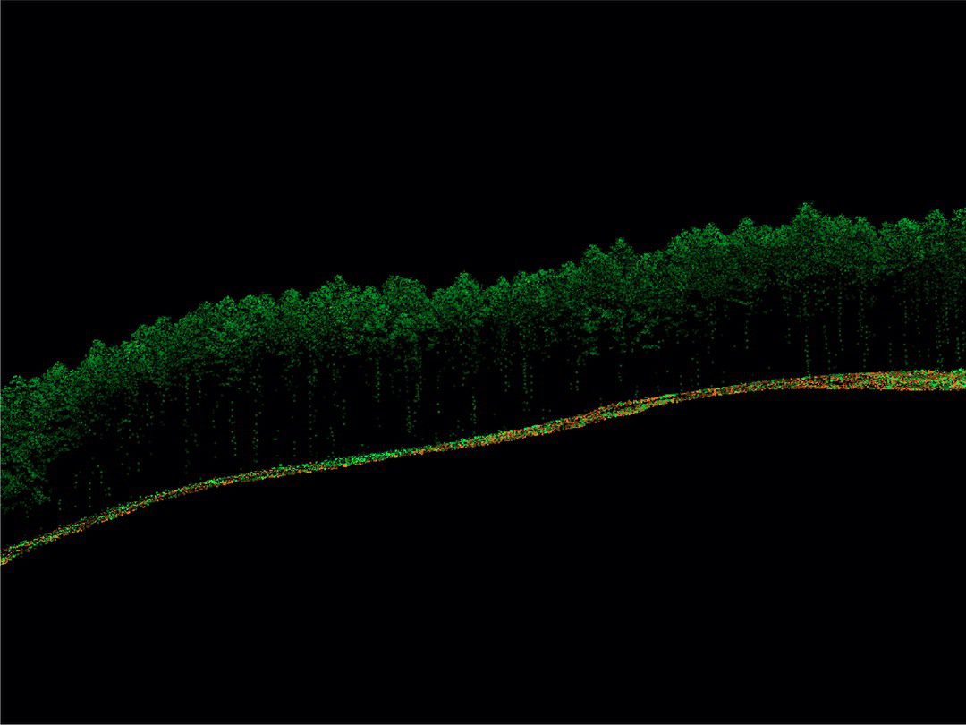
LiDAR provides terrain information with an accuracy of 50mm to 200mm even under vegetation. The firm completed its first LiDAR survey in 2005 and has acquired extensive experience in the field over hundreds of projects. We own two custom-built leading-edge sensors and are able to deploy both on a single project when required.
Professional-grade equipment ensures stable, high-quality output under various conditions.
SURVEY SOLUTIONS TAILORED TO YOUR NEEDS
COMPREHENSIVE LIDAR SURVEY CAPABILITIES
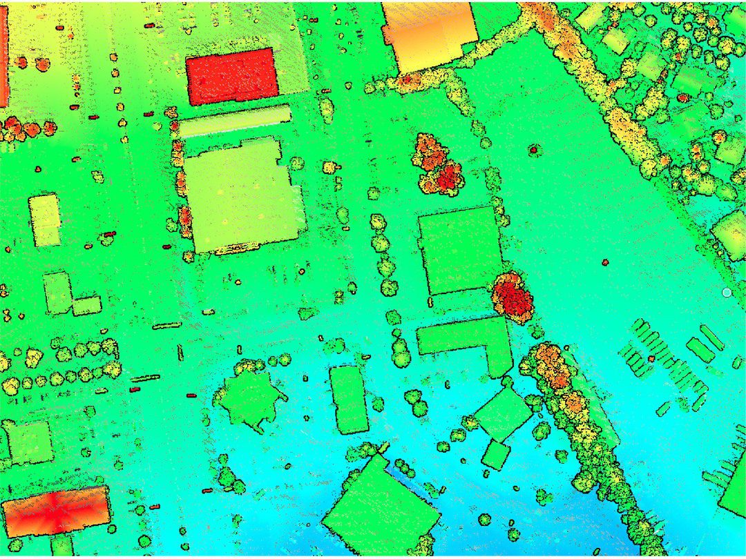
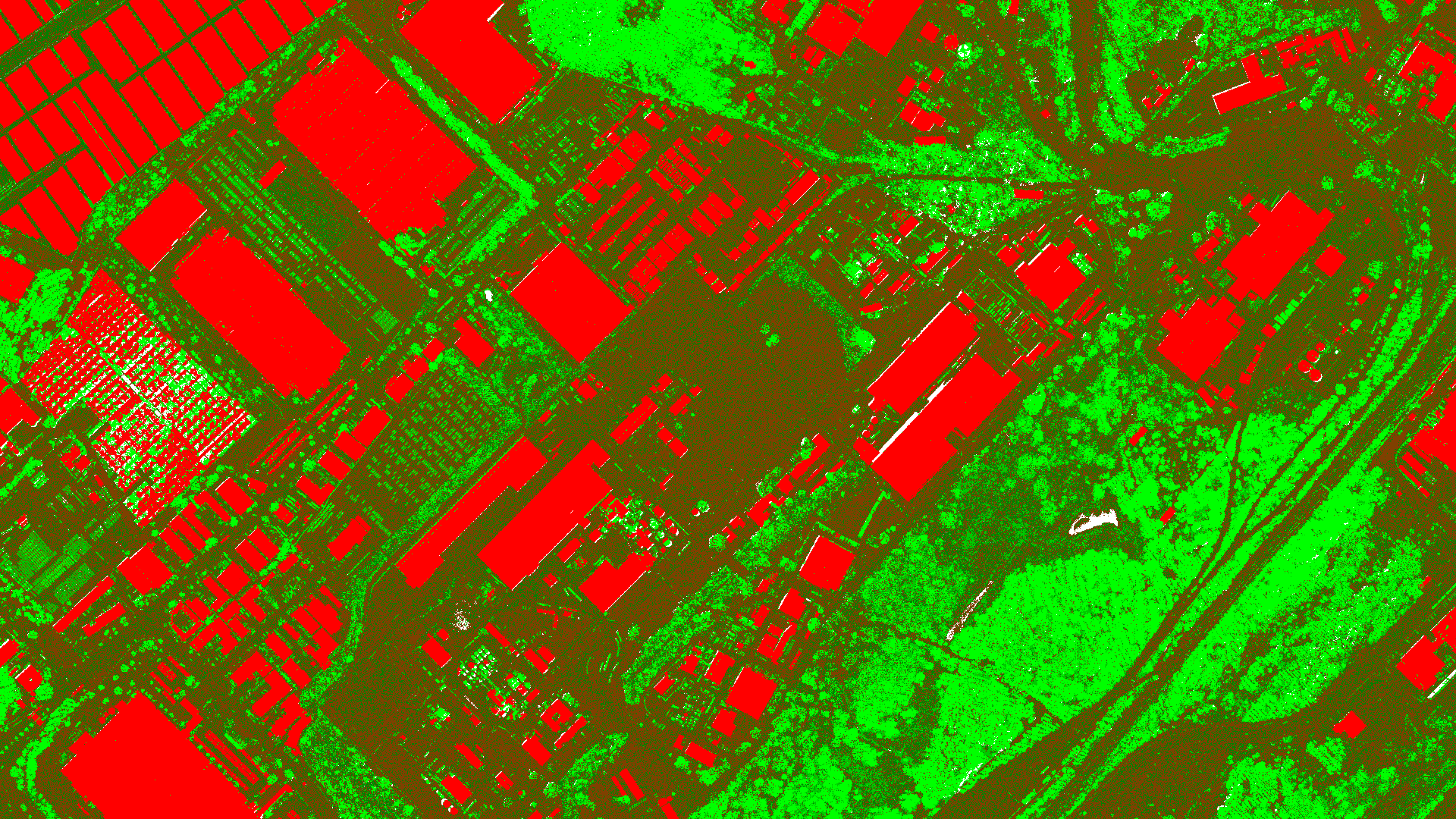
Geo-referenced aerial images with precise spatial accuracy for mapping and planning. High-Resolution DTM (Digital Terrain Models). Detailed topography data for land use planning and engineering. 3D Urban Modelling: Accurate 3D representations of urban areas for city planning and smart city projects.
OUR LIDAR SURVEY PROCESS
3-STEP PROCESS VISUALISATION:
1
Project Consultation
We start with a detailed consltation to understand your specific needs and project requirements, ensuring we tailor our imaging solution to your objectives.
2
Data Capture
Our experienced team uses large-format mapping cameras mounted on manned aircraft to capture data with pinpoint accuracy and wide coverage.
3
Data Processing and Delivery
After capturing the data, our team processes it for seamless integration into your workflows, providing high-quality deliverables ready for analysis.
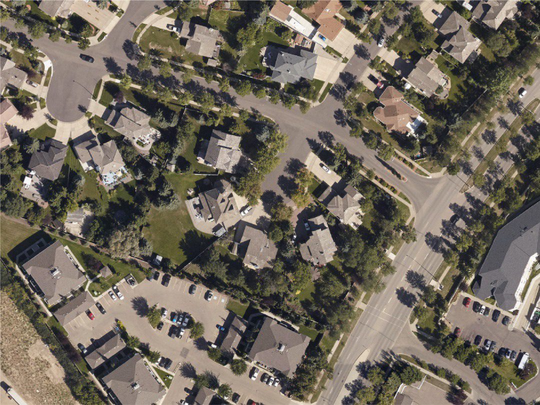
LiDAR (Light Detection and Ranging) uses laser pulses to measure distances from an aircraft to the ground. These measurements create highly detailed 3D models of terrain and features, even beneath vegetation canopies.
Aerial LiDAR provides unparalleled accuracy, captures data quickly over large areas, and can penetrate vegetation to map ground surfaces. It’s ideal for applications like flood modeling, slope analysis, and infrastructure planning.
Aerial LiDAR typically achieves vertical accuracy of ±5–15 cm and horizontal accuracy of ±30–50 cm, depending on the sensor, altitude, and ground control points (GCPs).
Yes, aerial LiDAR can penetrate vegetation by using multiple laser returns to distinguish ground features from tree canopies, enabling accurate terrain models in heavily forested areas.
LiDAR uses laser pulses to measure distances and is better for capturing elevation data and penetrating vegetation. Photogrammetry uses overlapping images to create 3D models but relies on visible surfaces, making it less effective in dense vegetation.
Click here to view the full range of our services.
PRECISION DATA COLLECTION FROM OUR STRATEGIC BASES
LIDAR SURVEY COVERAGE
From our worldwide strategic bases, we provide aerial imaging services to clients worldwide. From urban centers to remote landscapes, our team has the capacity to capture high-resolution data wherever your project is located.
We are continuously engaged in fascinating projects with inspirational clients!
"Wooding Geospatial Solutions have come up with an effective solution to the problem we were faced with. Thank you and we are looking forward to working with this team on our next project!"
Scott V.
"The service was excellent. The survey that Wooding Geospatial Solutions did for us was handled efficiently and professionally. We were very happy with the reports. Highly recommended!"
James S.
"We received the data, and are extremely happy with it. From the quality of the imagery to the extent of the final deliverables, it’s easily one of the best Orthophotography projects we’ve been involved in."
Rob M. - Vermillion County
"The LiDAR data has been a HUGE help, not only for drill planning but we have also been able to find a bunch of new outcrops now have been in the forest."
Pete S. - Virginia Mining Corporation
"Wooding Geospatial Solutions is a professional organisation and all work has been delivered timeously and to specification."
Patrick G. - GeodesyGroup Inc.
START YOUR LIDAR PROJECT TODAY
Our team is ready to deliver precise, large-scale data to meet the unique needs of your project. Contact us today to discuss your requirements and receive a customized quote.