WGS has developed a purpose-built oblique imaging multicamera rig that sets a new standard in geospatial data collection. This cutting-edge system is comprised of five cameras, each synchronized and linked to survey-grade GNSS and inertial measurement systems. By integrating these technologies, the system ensures precise data capture, enabling unparalleled accuracy for geospatial modeling.
The multicamera rig features a strategic configuration: four 50mm cameras oriented forward, right, back, and left, each pointing 23° below the horizon, and a single 24mm camera facing directly downward. This arrangement allows the system to capture a comprehensive range of views during a flight. With careful flight planning, all visible surfaces of a building or façade can be captured in multiple overlapping frames, ensuring robust object geometry for further analysis.
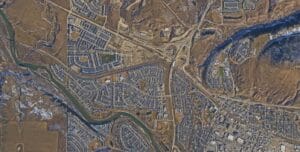
Creating Digital Twins with Photogrammetry
The innovative imaging system is capable of generating a digital twin of any area it surveys. Using photogrammetric techniques and high-performance computing hardware, a dense point cloud is derived from the collected imagery. This point cloud forms the foundation of the geometric model, representing every structure and surface within the area of interest.
To enhance realism, textures are created by aggregating the input imagery and draping them over the triangulated faces of the geometric model. The result is a highly detailed, photorealistic representation of the surveyed area. The accuracy and detail captured allow for the model to be mapped to real-world coordinates in all three dimensions, ensuring precise alignment with the physical world.
Applications of the Digital City Model
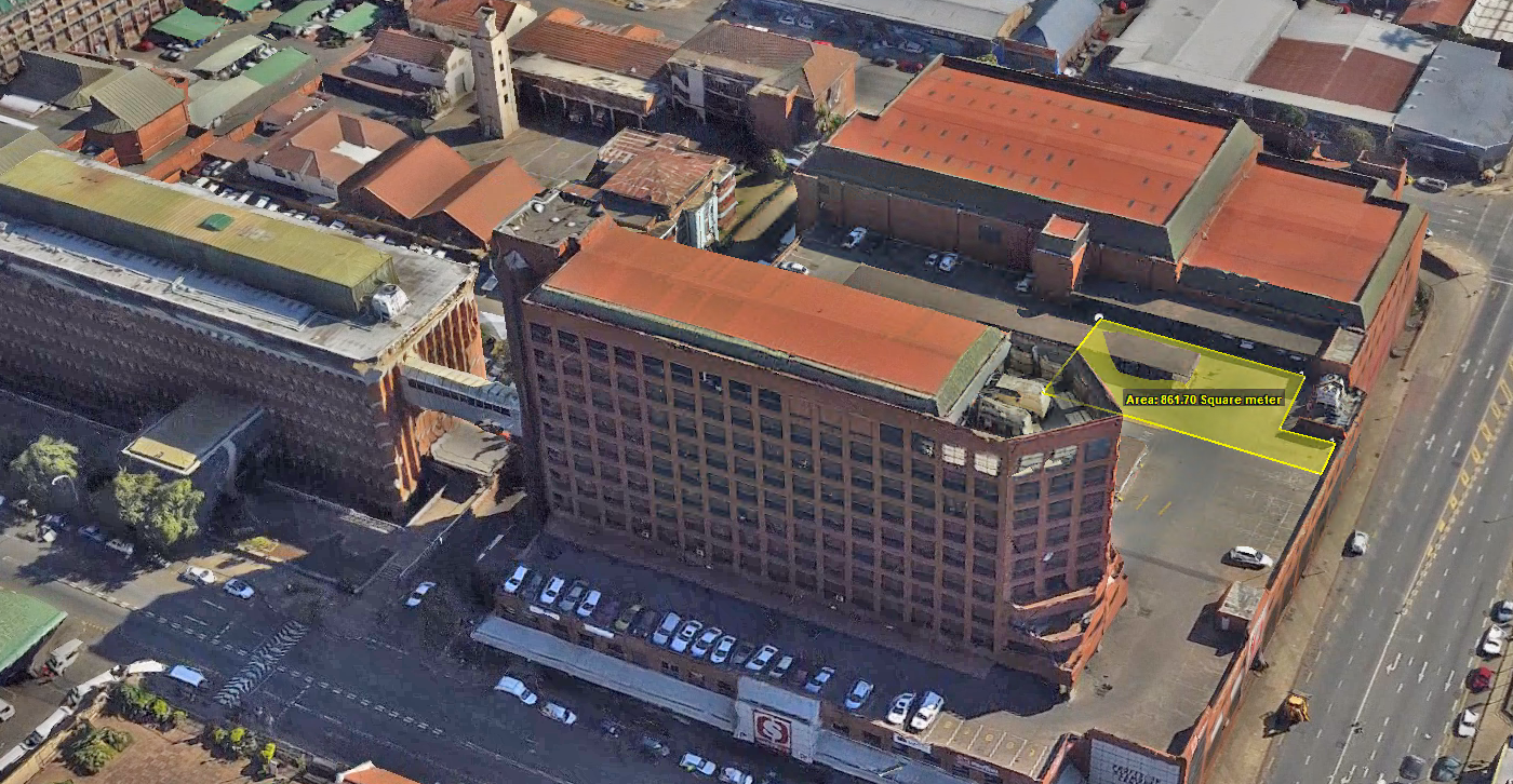
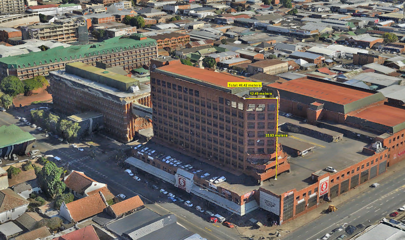
This technology enables the creation of fully navigable digital city models, offering unprecedented functionality and versatility. Every surface in the model is measurable, allowing users to assess critical urban features such as road widths, the heights of streetlights, roof slopes, and even viewsheds. This comprehensive capability makes the model a valuable resource for city planners, architects, engineers, and various other professionals.
By hosting the models online, entire cities can be explored digitally from any computer with internet access. Users can measure, record, and catalog aspects of the city remotely, streamlining processes like urban planning, infrastructure management, and disaster response preparation.
A Revolutionary Tool for Urban Analysis
WGS’s oblique imaging system and digital city modeling technology represent a leap forward in geospatial data collection and analysis. With the ability to produce accurate, photorealistic, and fully measurable models of entire cities, this technology is transforming how urban areas are studied, managed, and developed.