TRANSFORMING TOWN PLANNING WITH PRECISION AERIAL SURVEYS
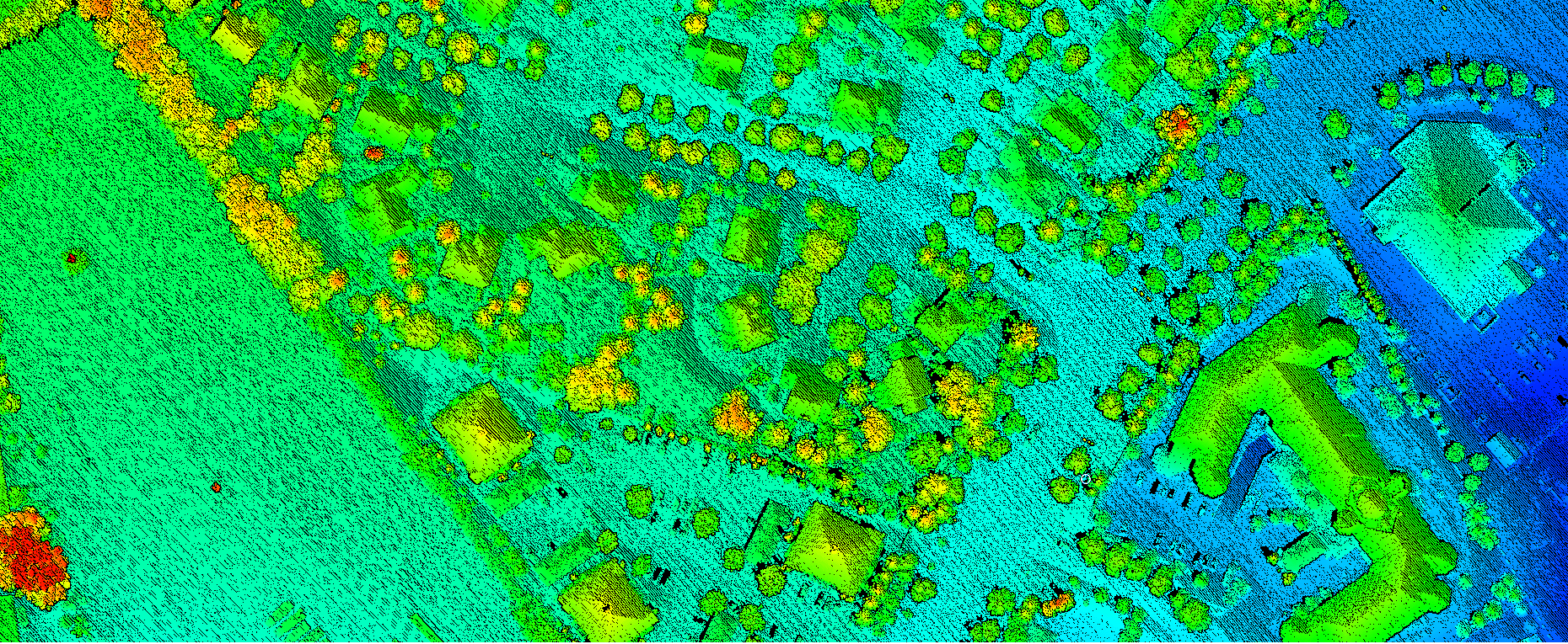
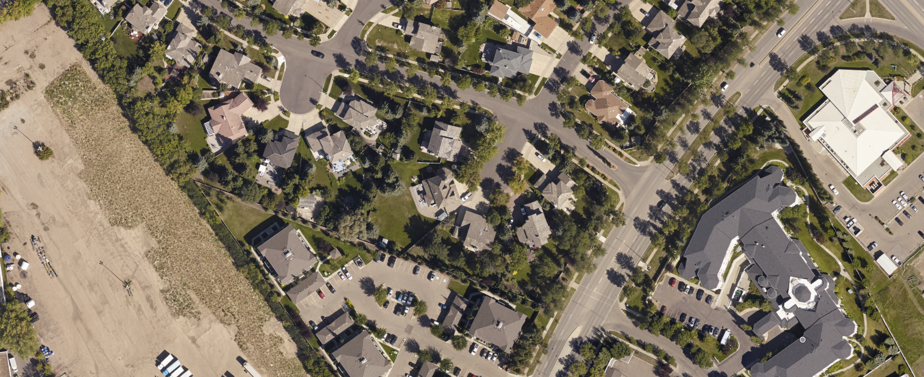
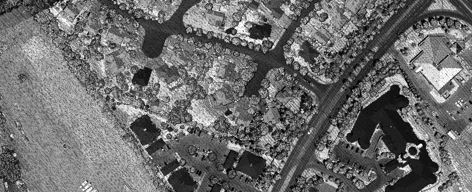
Aerial surveys provide an efficient and accurate way to collect vital geospatial data for urban environments. Whether it’s creating detailed maps or integrating advanced analytics, aerial surveys enable towns to optimize planning, management, and resource allocation. By utilizing cutting-edge technologies like LiDAR and oblique imagery, we deliver actionable insights tailored to your urban mapping needs. Advantages of Aerial Surveys Include:
Comprehensive Coverage: Capture large areas quickly, reducing the time and cost of traditional ground surveys.
High Accuracy: Achieve centimeter-level precision, ideal for urban planning and decision-making.
Flexibility: Adaptable to various project scales, from small neighborhoods to entire towns.
OUR SOLUTIONS
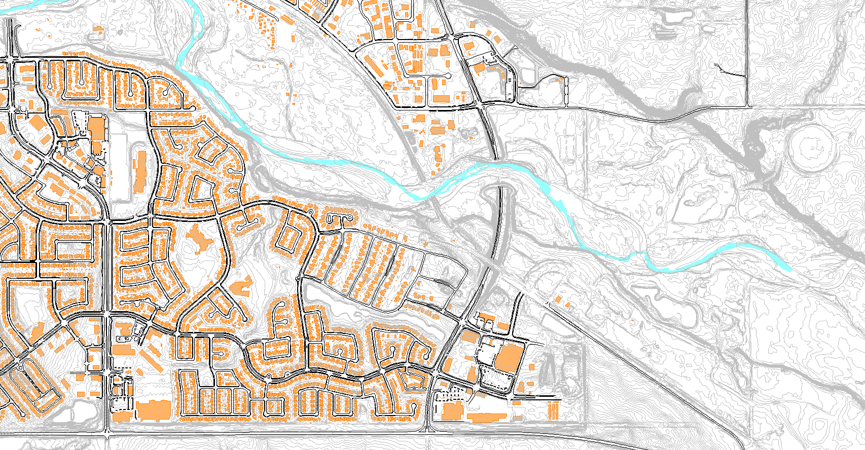
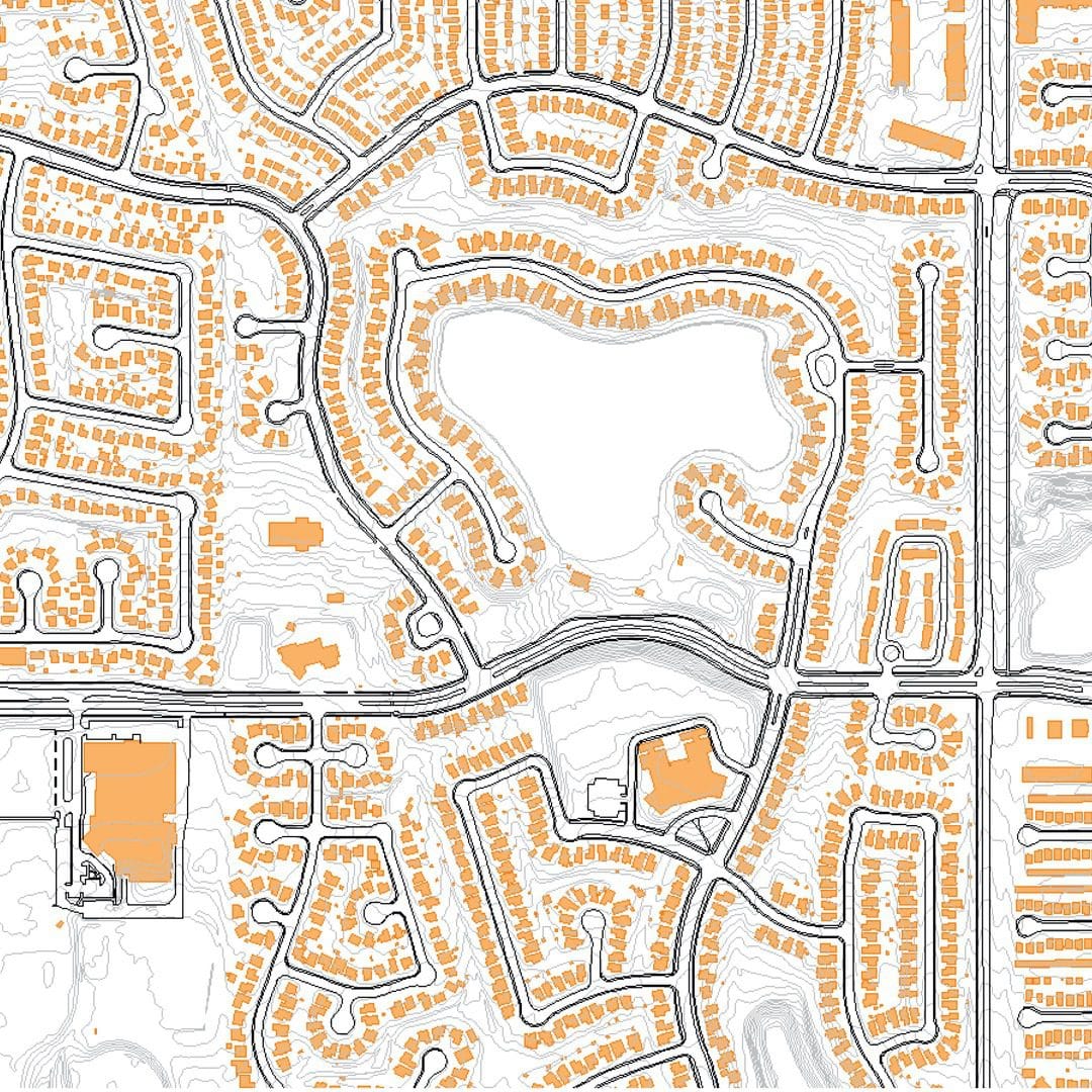
USES FOR OUR URBAN MAPPING DATA
Our urban mapping data is designed to meet diverse project needs with precision and efficiency. Using multiple, advanced cameras and sensors, we ensure your specific requirements are fulfilled, providing the critical insights needed for successful planning and development.
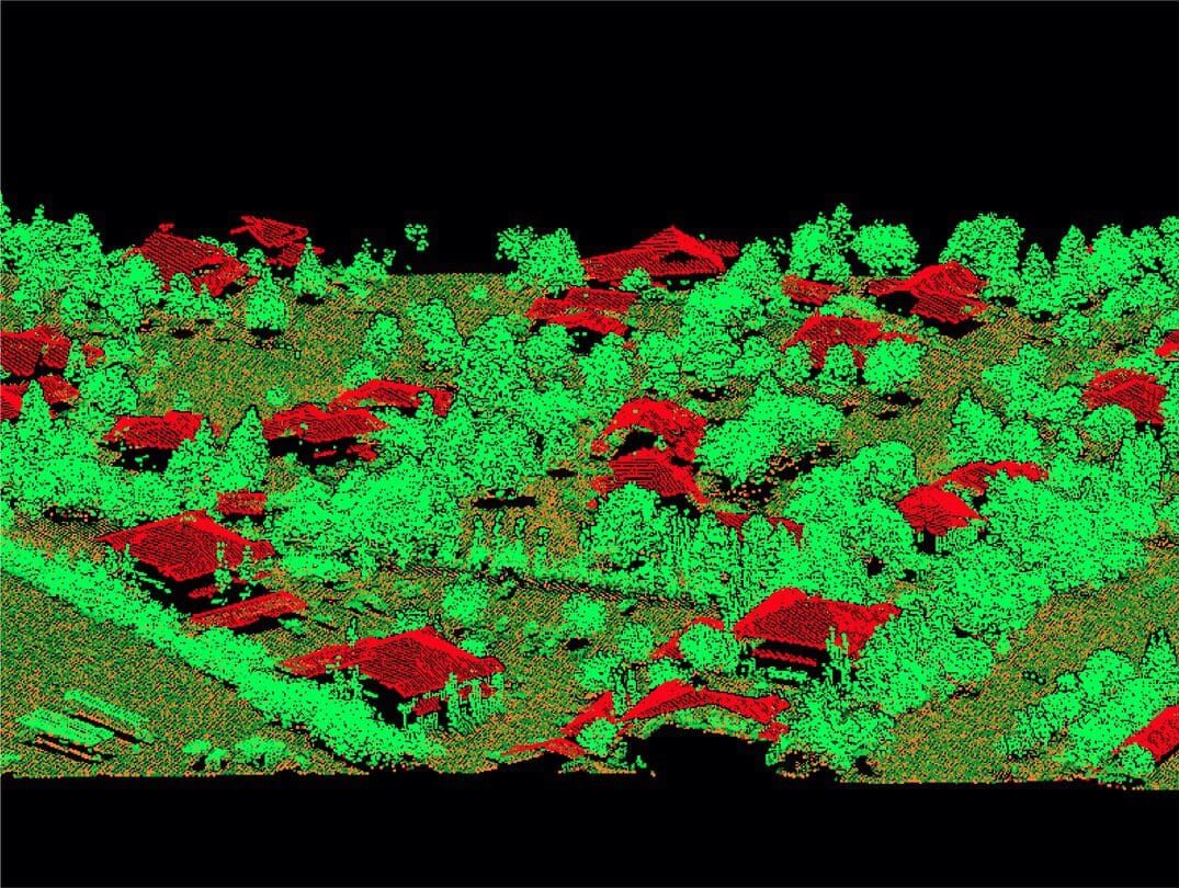
Aerial surveys support the development of digital twins—virtual replicas of urban areas. These allow towns to:
Simulate and analyze urban scenarios, such as infrastructure projects or traffic flows.
Predict and mitigate risks, including flood impacts or infrastructure failures.
Plan future developments with precision and foresight.
SURVEY SOLUTIONS TAILORED TO YOUR NEEDS
SOLUTIONS FOR SMARTER URBAN MANAGEMENT
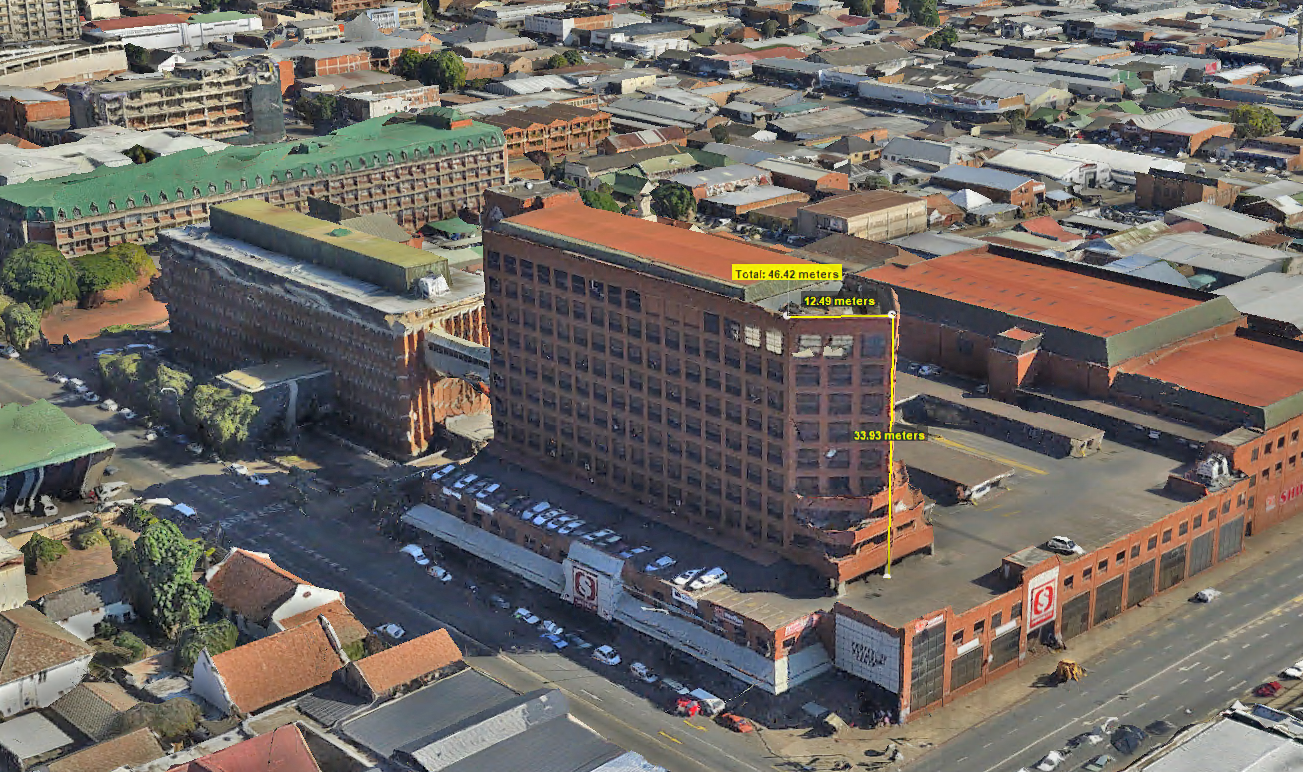
Leverage the power of LiDAR, aerial imagery and oblique imaging to revolutionize your planning operations. From precise volumetric measurements to detailed terrain mapping, our solutions deliver actionable insights for enhanced efficiency and safety.
Our surveys provide topographical mapping, stockpile measurements, volumetric analysis, ecological assessments, and detailed 3D models for operational planning and compliance.
Aerial surveys offer rapid data collection, increased safety, and precise measurements, making them ideal for hard-to-reach areas and large-scale operations.
Yes, our surveys generate detailed and accurate reports that meet regulatory requirements, ensuring compliance with environmental and operational standards.
The frequency depends on the operation, but periodic surveys are recommended for monitoring progress, managing stockpiles, and ensuring safety and efficiency.
We use advanced drones, LiDAR systems, 3D scanning, and high-resolution cameras to deliver precise and actionable data for your projects.
DELIVERING HIGH-QUALITY AERIAL SURVEYS WHEREVER YOU NEED
GLOBAL REACH, LOCAL PRECISION
Our services are available worldwide. Whether your project is in remote areas, across challenging terrain, or in urban landscapes, our team can deploy an equipped aircraft to capture precise data wherever you need it.
With operational capabilities spanning continents, we bring advanced geospatial solutions directly to your location, ensuring that distance and geography are never barriers to high-quality aerial data.
We are continuously engaged in fascinating projects with inspirational clients!
"Wooding Geospatial Solutions have come up with an effective solution to the problem we were faced with. Thank you and we are looking forward to working with this team on our next project!"
Scott V.
"The service was excellent. The survey that Wooding Geospatial Solutions did for us was handled efficiently and professionally. We were very happy with the reports. Highly recommended!"
James S.
"We received the data, and are extremely happy with it. From the quality of the imagery to the extent of the final deliverables, it’s easily one of the best Orthophotography projects we’ve been involved in."
Rob M. - Vermillion County
"The LiDAR data has been a HUGE help, not only for drill planning but we have also been able to find a bunch of new outcrops now have been in the forest."
Pete S. - Virginia Mining Corporation
"Wooding Geospatial Solutions is a professional organisation and all work has been delivered timeously and to specification."
Patrick G. - GeodesyGroup Inc.
UNLOCK THE POTENTIAL OF URBAN MAPPING
With our expertise in aerial surveys, LiDAR, and oblique imagery, we help towns transform their geospatial data into actionable insights. Contact us today to learn how we can support your urban mapping projects.