ADVANCED ENVIRONMENTAL MONITORING WITH AERIAL SURVEYING
Aerial surveys provide critical geospatial insights for environmental research, conservation, and land management. High-resolution imagery and LiDAR technology allow for accurate monitoring of ecosystems, biodiversity, land use changes, and climate impact. By delivering detailed, data-driven analysis, these surveys help organizations make informed decisions to protect and manage natural resources effectively.
Combine aerial data with GIS tools for enhanced environmental modeling and analysis.
INDUSTRY APPLICATIONS
SUPPORTING ENVIRONMENTAL CONSERVATION & POLICY
Aerial surveys provide valuable insights for various environmental sectors, enabling data-driven conservation efforts.
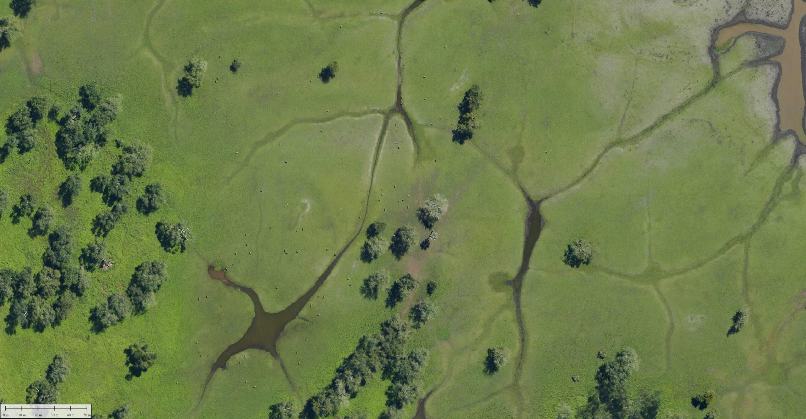
Forest & Wildlife Conservation
Track deforestation, illegal logging, and species population changes.
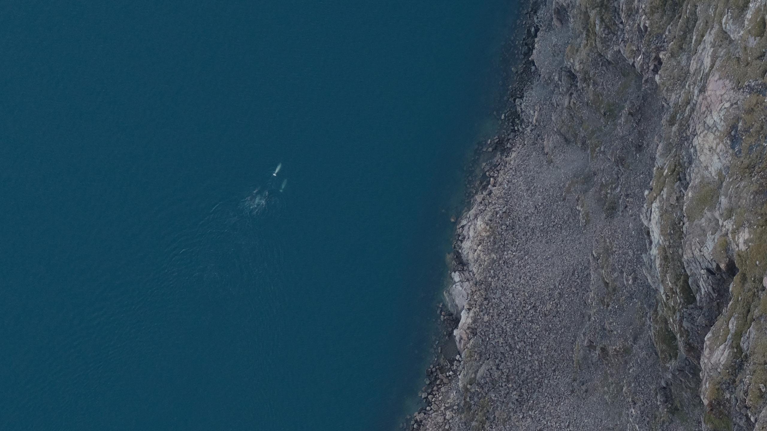
Coastal & Wetland Protection
Monitor shoreline retreat, flood risks, and habitat degradation
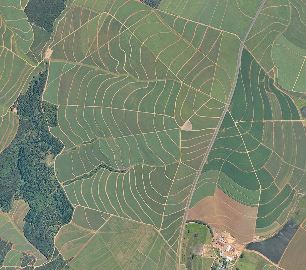
Agricultural & Land Management
Assess soil health, irrigation efficiency, and sustainable farming practices.
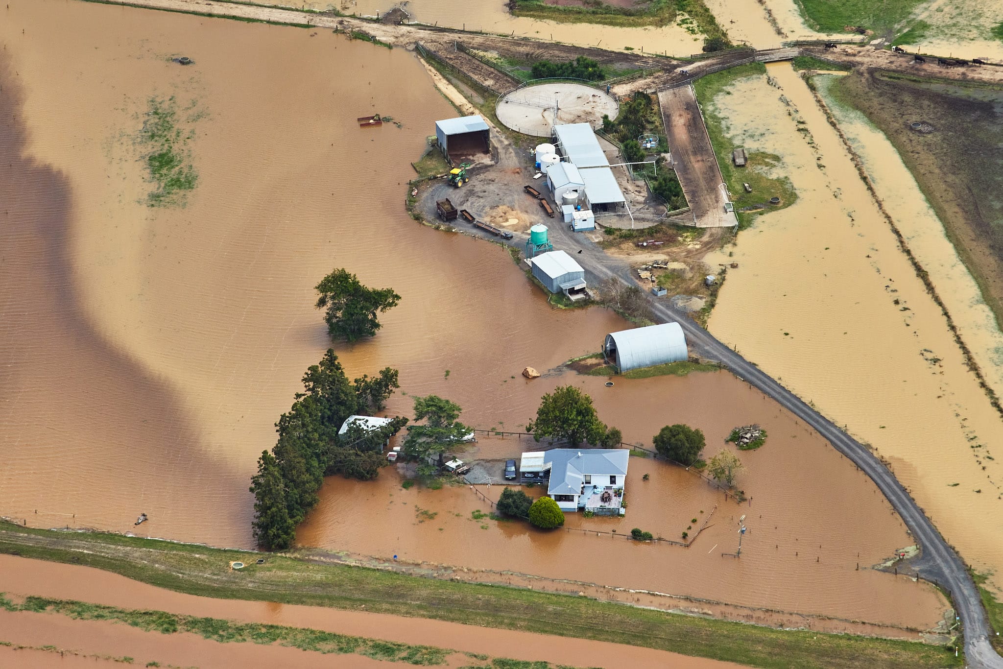
Disaster & Climate Resilience Planning
Support mitigation strategies for wildfires, floods, and climate-related threats.
HOW IT WORKS
SEAMLESS SURVEYING FOR ENVIRONMENTAL PROJECTS
We’ve streamlined our aerial survey process to deliver fast, accurate, and actionable data to keep your projects moving forward. Our end-to-end service ensures you get the insights you need with minimal disruption to your operations.
1
Project Consultation & Planning
We begin by understanding your project requirements, defining the survey scope, and planning the optimal data capture strategy tailored to your objectives.
2
Data Acquisition
Using state-of-the-art aerial platforms equipped with LiDAR and high-resolution cameras, we capture precise data across your project area quickly and safely.
3
Data Processing & Analysis
Our expert team processes the captured data, generating topographic maps, 3D models, GIS-ready datasets, and trend reports with the highest accuracy standards.
4
Data Delivery & Insights
Receive your data in the formats you need, complete with actionable insights for design optimization, project monitoring, and compliance reporting.
They provide accurate, large-scale monitoring of landscapes, habitats, and natural resources, helping organizations track changes over time and implement conservation strategies.
Our surveys capture vegetation indices, water quality data, thermal imaging, topography, and land use changes to support environmental research and policy-making.
LiDAR and multispectral imaging can detect environmental shifts with high precision, often within centimeters, providing reliable data for climate change assessments.
Yes, specialized imaging techniques can identify water pollution, oil spills, soil degradation, and air quality issues for early detection and mitigation.
Aerial surveys cover vast areas quickly and efficiently, reducing costs while providing higher-resolution data than many traditional ground-based methods.
DELIVERING HIGH-QUALITY AERIAL SURVEYS WHEREVER YOU NEED
GLOBAL REACH, LOCAL PRECISION
Our services are available worldwide. Whether your project is in remote areas, across challenging terrain, or in urban landscapes, our team can deploy an equipped aircraft to capture precise data wherever you need it.
With operational capabilities spanning continents, we bring advanced geospatial solutions directly to your location, ensuring that distance and geography are never barriers to high-quality aerial data.
We are continuously engaged in fascinating projects with inspirational clients!
"Wooding Geospatial Solutions have come up with an effective solution to the problem we were faced with. Thank you and we are looking forward to working with this team on our next project!"
Scott V.
"The service was excellent. The survey that Wooding Geospatial Solutions did for us was handled efficiently and professionally. We were very happy with the reports. Highly recommended!"
James S.
"We received the data, and are extremely happy with it. From the quality of the imagery to the extent of the final deliverables, it’s easily one of the best Orthophotography projects we’ve been involved in."
Rob M. - Vermillion County
"The LiDAR data has been a HUGE help, not only for drill planning but we have also been able to find a bunch of new outcrops now have been in the forest."
Pete S. - Virginia Mining Corporation
"Wooding Geospatial Solutions is a professional organisation and all work has been delivered timeously and to specification."
Patrick G. - GeodesyGroup Inc.
READY TO ELEVATE YOUR ENVIRONMENTAL PROJECTS?
Leverage the power of LiDAR and aerial imagery to make data-driven decisions and achieve your management goals.