WGS provides professional GIS services designed to transform data into actionable insights. By leveraging cutting-edge mapping technologies and geospatial data analysis, we empower industries with precise spatial intelligence solutions.
Delivering actionable insights through advanced mapping.
Providing customized GIS applications for client needs.
Enhancing decision-making with detailed geospatial analysis.
Offering a wide range of GIS services for various industries.
TURNING DATA INTO DYNAMIC SOLUTIONS.
At WGS, we specialise in comprehensive GIS solutions tailored to diverse industry needs. Our services empower clients with accurate geospatial data, enhancing decision-making processes and operational efficiency.
We offer professional map creation, web mapping, and thematic mapping services. Our expert team delivers high-quality, interactive maps suited for various applications, from project planning to public presentations.
Our data services cover field data collection, data integration, and data maintenance. We ensure seamless data capture and ongoing accuracy, supporting informed decision-making with reliable geospatial datasets.
Our advanced spatial analysis services include buffer analysis, overlay analysis, and spatial statistics. These analytical tools provide critical insights for site selection, environmental impact assessments, and infrastructure planning.
WGS offers custom GIS development and specialized GIS training and support. We work closely with clients to develop personalized GIS tools and ensure teams are fully equipped to maximize their geospatial capabilities.
Our remote sensing expertise covers change detection and object detection. We use state-of-the-art satellite and aerial data to monitor landscape changes and identify key features with precision.
We create dynamic dashboards and 3D visualizations that bring geospatial data to life. Our visualizations help clients understand complex datasets intuitively and make data-driven decisions with confidence.
SURVEY SOLUTIONS TAILORED TO YOUR NEEDS
GEOGRAPHICAL INFORMATION SYSTEMS CAPABILITIES
Geo-referenced aerial images with precise spatial accuracy for mapping and planning. High-Resolution DTM (Digital Terrain Models). Detailed topography data for land use planning and engineering. 3D Urban Modelling: Accurate 3D representations of urban areas for city planning and smart city projects.
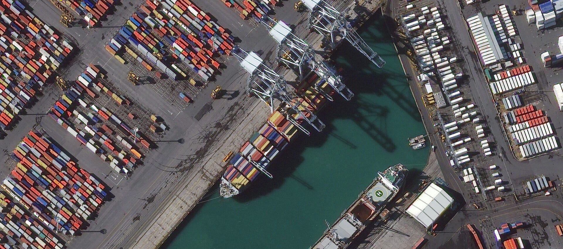
Manilla Port Mapping
UAV port terminal survey showcasing the advancements in drone technology. Click Here
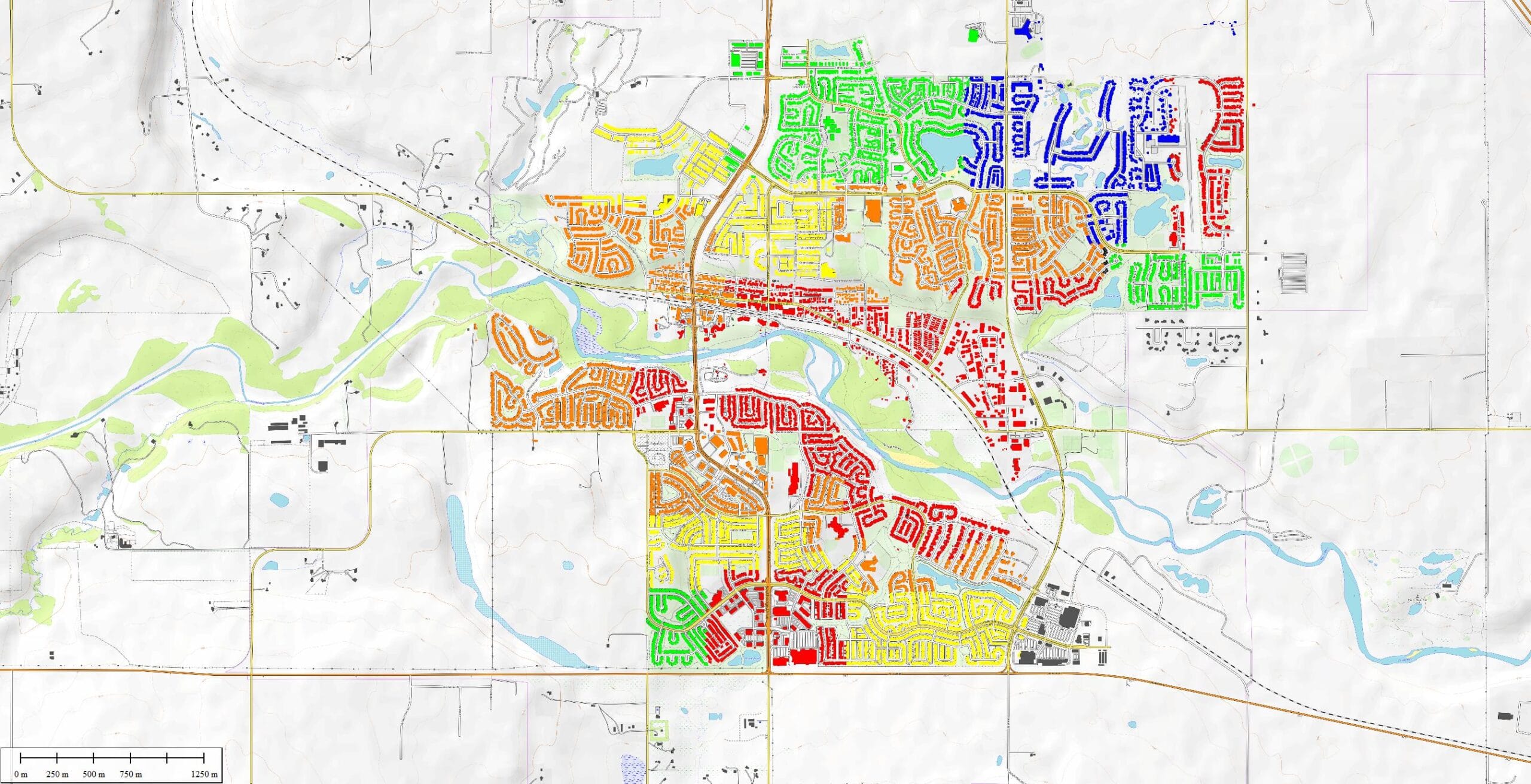
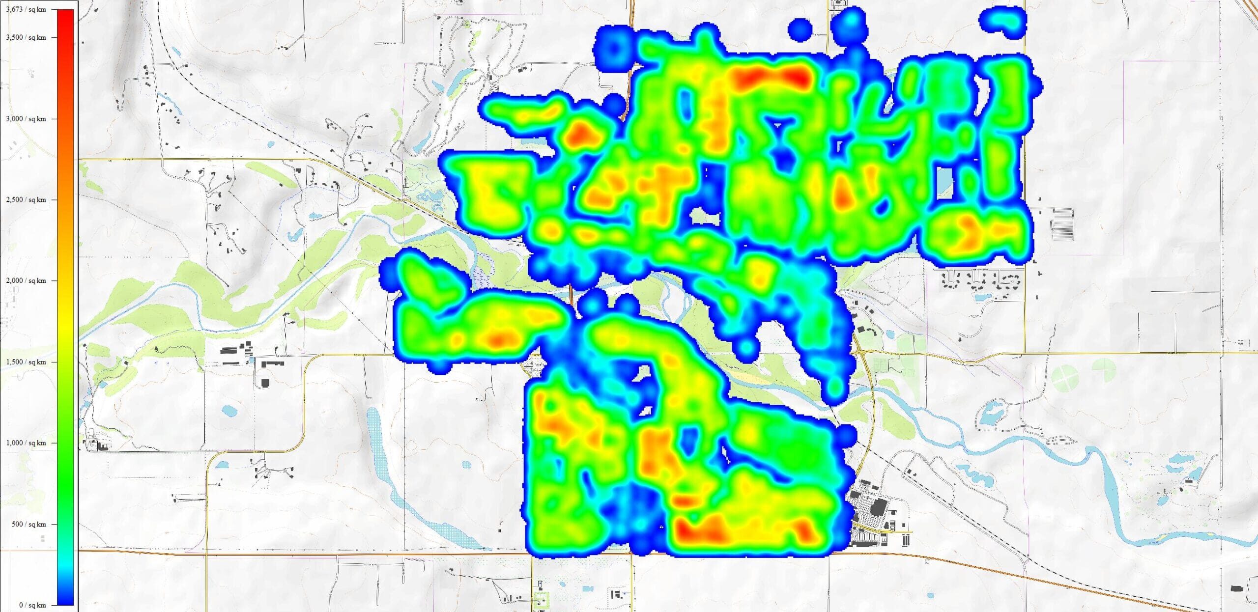
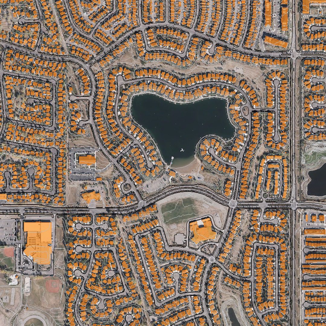
Town Mapping
Town mapping and urban planning in Alberta, Canada. Click Here
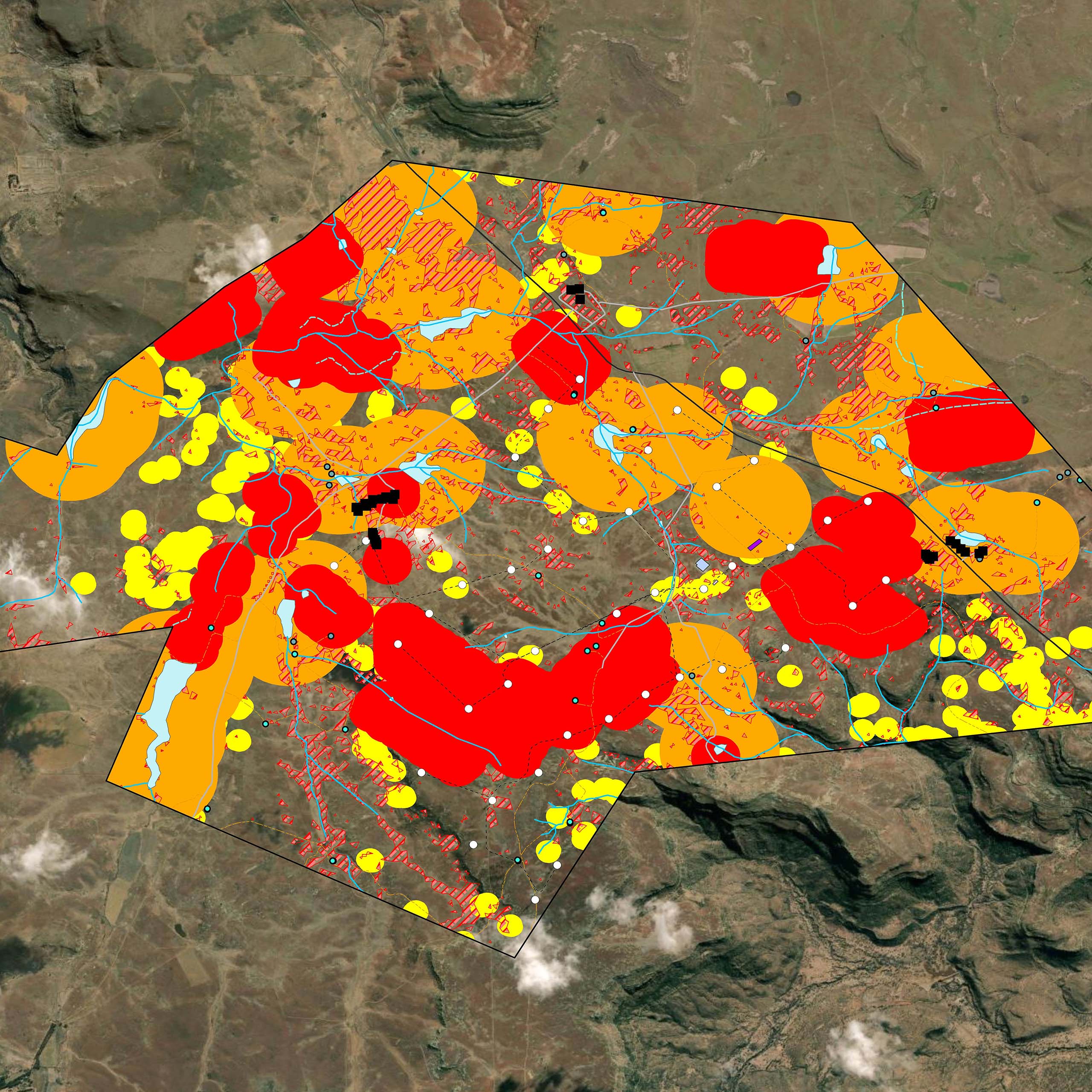
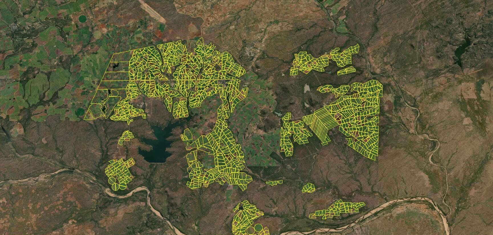
Sugar Crop Area Audit
Southern Africa sugar crop area audit. Leveraging satellite data for agricultural analysis. Click Here
OUR GIS PROCESS
3-STEP PROCESS VISUALISATION:
1
Project Consultation
We start with a detailed consltation to understand your specific needs and project requirements, ensuring we tailor our imaging solution to your objectives.
2
Data Capture
Our experienced team uses large-format mapping cameras mounted on manned aircraft to capture data with pinpoint accuracy and wide coverage.
3
Data Processing and Delivery
After capturing the data, our team processes it for seamless integration into your workflows, providing high-quality deliverables ready for analysis.
GIS (Geographic Information System) is a framework for capturing, analysing, and visualizing spatial data. Aerial surveys provide high-resolution imagery and geospatial data, which can be integrated into GIS platforms for mapping and analysis.
Aerial surveys produce data such as: Orthophotos (georeferenced imagery) Digital Elevation Models (DEMs) Contour maps LiDAR point clouds Vegetation, infrastructure, and land-use classifications
Aerial survey data is typically delivered in GIS-compatible formats such as: Shapefiles (.shp) GeoTIFF (.tif) KML/KMZ (for Google Earth) DEM/DTM files (.asc, .flt) CSV or database formats for attribute data.
Aerial survey data provides precise, up-to-date spatial information that can be analysed in GIS to identify patterns, predict outcomes, and optimize resource allocation, improving decision-making in various industries.
Yes, GIS data from aerial surveys can be combined with other datasets, such as historical maps, satellite imagery, or demographic data, to create comprehensive analyses and insights.
We are continuously engaged in fascinating projects with inspirational clients!
"Wooding Geospatial Solutions have come up with an effective solution to the problem we were faced with. Thank you and we are looking forward to working with this team on our next project!"
Scott V.
"The service was excellent. The survey that Wooding Geospatial Solutions did for us was handled efficiently and professionally. We were very happy with the reports. Highly recommended!"
James S.
"We received the data, and are extremely happy with it. From the quality of the imagery to the extent of the final deliverables, it’s easily one of the best Orthophotography projects we’ve been involved in."
Rob M. - Vermillion County
"The LiDAR data has been a HUGE help, not only for drill planning but we have also been able to find a bunch of new outcrops now have been in the forest."
Pete S. - Virginia Mining Corporation
"Wooding Geospatial Solutions is a professional organisation and all work has been delivered timeously and to specification."
Patrick G. - GeodesyGroup Inc.
START YOUR GIS PROJECT TODAY
Our team is ready to deliver precise, large-scale data to meet the unique needs of your project. Contact us today to discuss your requirements and receive a customized quote.