ENHANCING RENEWABLE DEVELOPMENT WITH AERIAL SURVEYS
Accurate geospatial data is essential for efficient renewable energy planning and infrastructure development. Aerial surveys provide high-resolution insights that support site evaluation, environmental assessments, and project execution. Whether for wind, solar, or hydro projects, these surveys help maximize efficiency, minimize risks, and streamline the entire development process.
Ensure smooth connection of renewable energy sources to existing utility networks.
KEY FEATURES
ADVANCED SURVEYING FOR SMARTER RENEWABLE ENERGY PROJECTS
Optimise your renewable energy projects with state-of-the-art aerial survey technology, delivering precise, data-rich insights for smarter decision-making. Our advanced geospatial tools provide the critical information needed to assess site viability, enhance planning, and mitigate risks. From wind farm layouts to solar panel positioning, our surveys ensure efficiency, sustainability, and seamless integration with energy infrastructure. Gain a competitive edge with accurate mapping, environmental assessments, and topographic analysis designed to drive successful renewable energy development at every stage of your project.
Integrate survey results into GIS systems for improved planning and decision-making.
INDUSTRY APPLICATIONS
RENEWABLE ENERGY SURVEYS APPLICATIONS ACROSS INDUSTRIES
We provide data-driven insights that support the growth and sustainability of various renewable energy sectors.
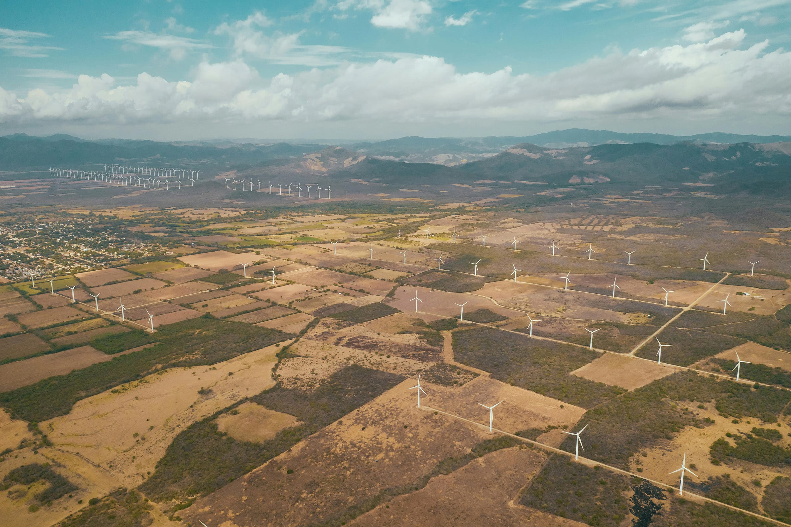
Wind Energy Projects
Ensure proper siting of turbines based on wind speed analysis and terrain mapping.
Solar Farms
Plan panel layouts with precision to maximize solar exposure and minimize obstructions.
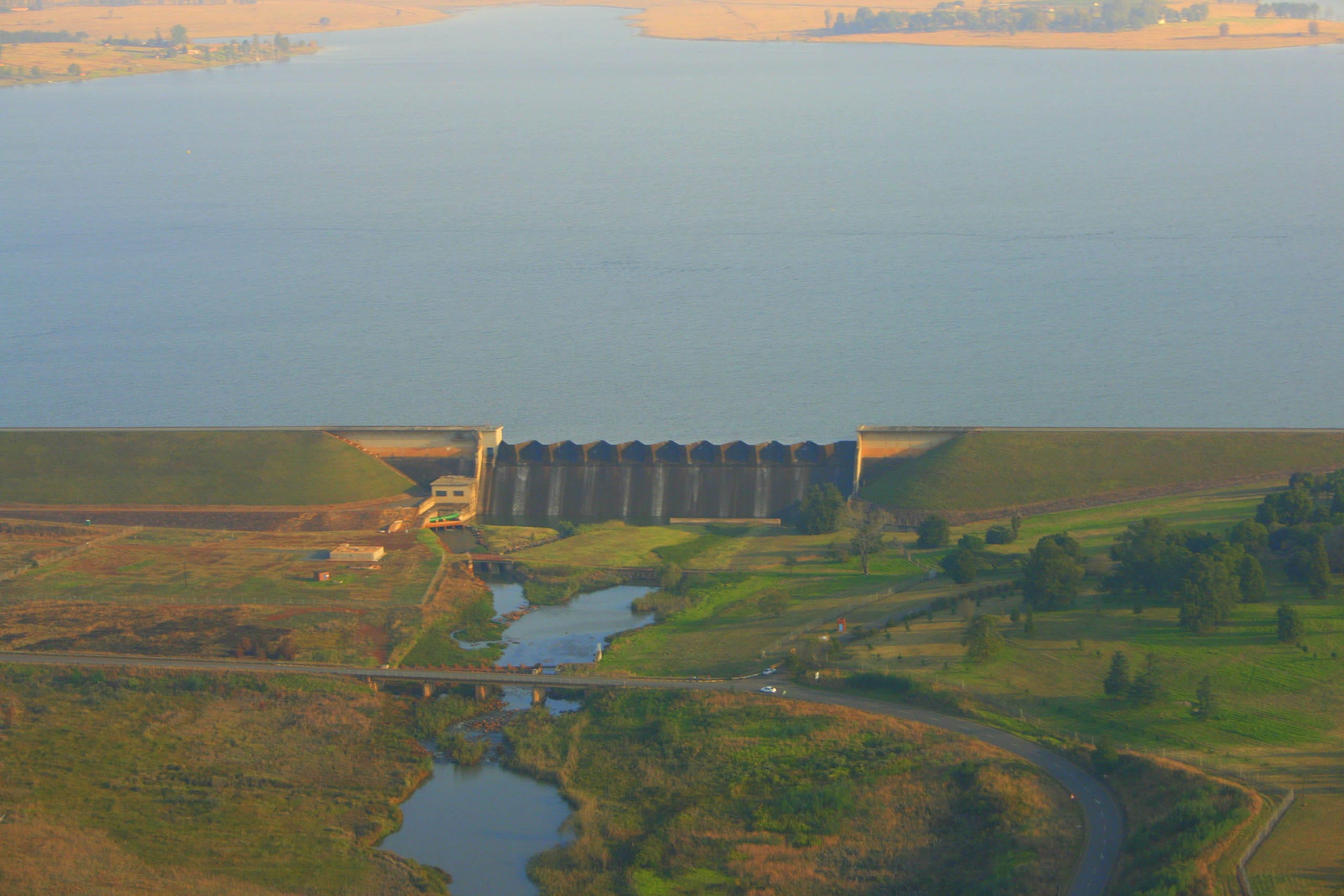
Hydropower Facilities
Survey water bodies, elevations, and environmental factors for effective design.
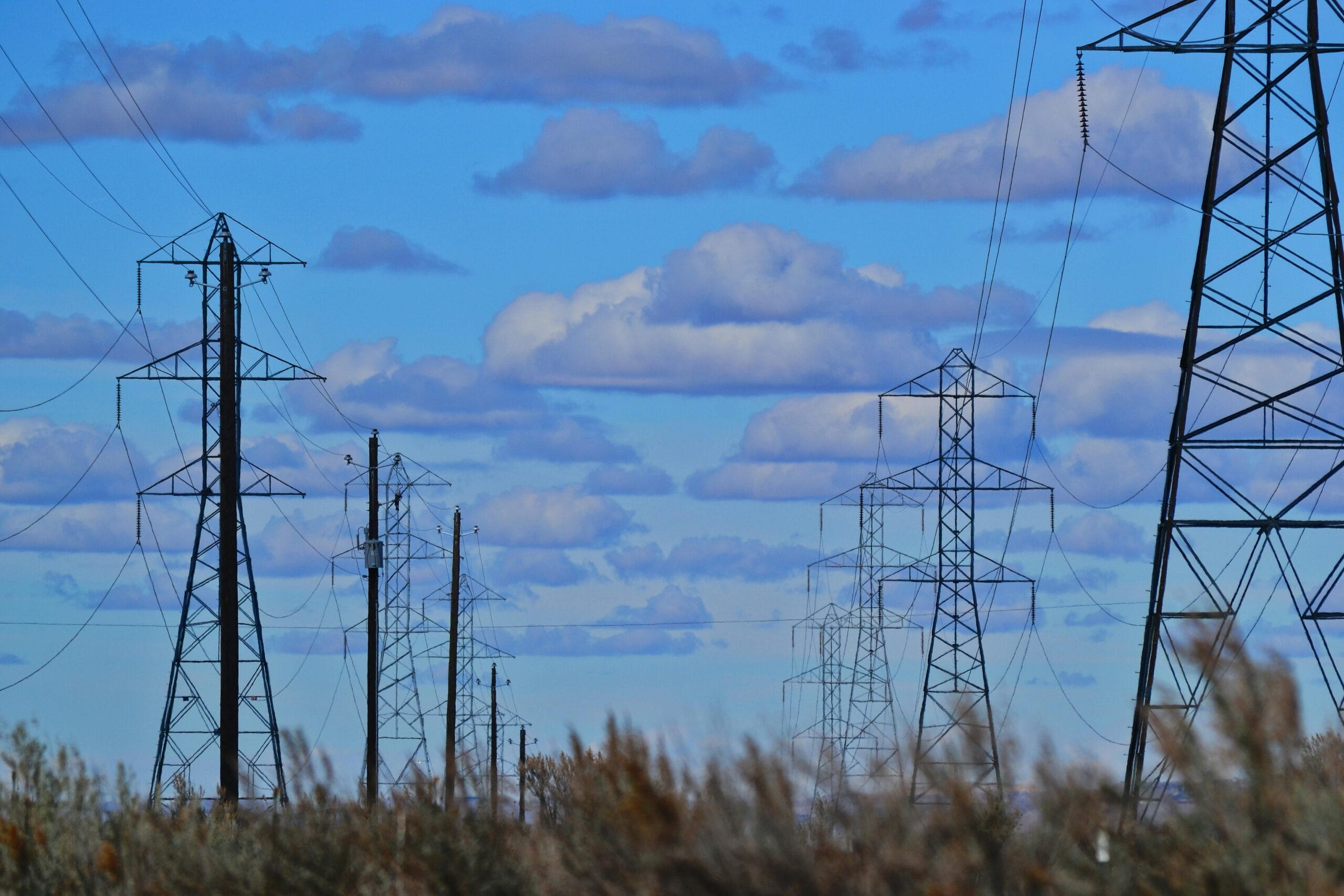
Power Transmission Networks
Support grid expansion and renewable energy integration with detailed mapping.
HOW IT WORKS
SEAMLESS AERIAL SURVEYING FOR RENEWABLE PROJECTS
We’ve streamlined our aerial survey process to deliver fast, accurate, and actionable data to keep your projects moving forward. Our end-to-end service ensures you get the insights you need with minimal disruption to your operations.
1
Project Consultation & Planning
We begin by understanding your project requirements, defining the survey scope, and planning the optimal data capture strategy tailored to your site and objectives.
2
Data Acquisition
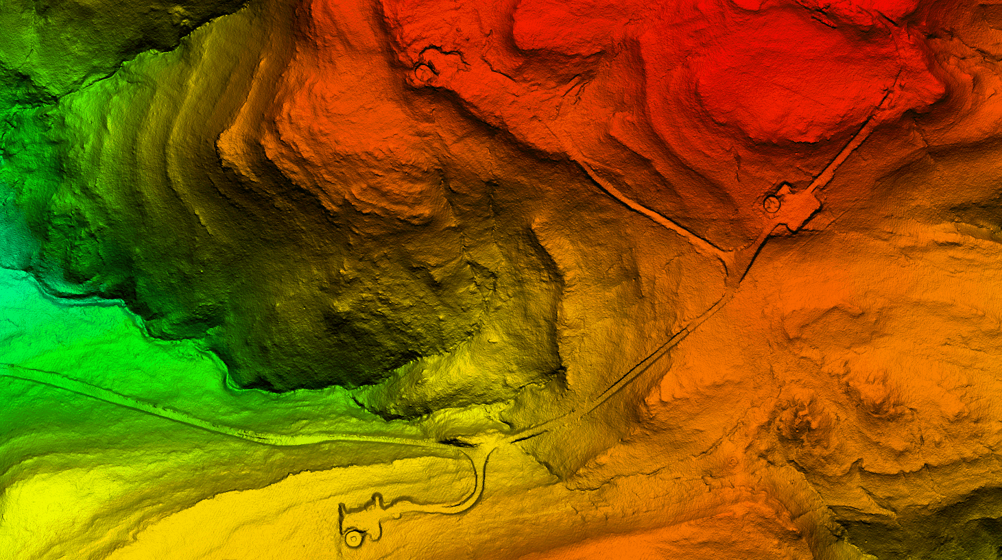
Using state-of-the-art aerial platforms equipped with LiDAR and high-resolution cameras, we capture precise geospatial data across your project area quickly and safely.
3
Data Processing & Analysis
Our expert team processes the captured data, generating topographic maps, 3D models, and GIS-ready datasets with the highest accuracy standards.
4
Data Delivery & Insights
Receive your data in the formats you need, complete with actionable insights for design optimization, project monitoring, and compliance reporting.
Our LiDAR surveys achieve vertical accuracy within ±5 cm and horizontal accuracy within ±10 cm, depending on terrain and flight altitude. Photogrammetry data typically delivers accuracy within ±2 pixels of ground sample distance (GSD).
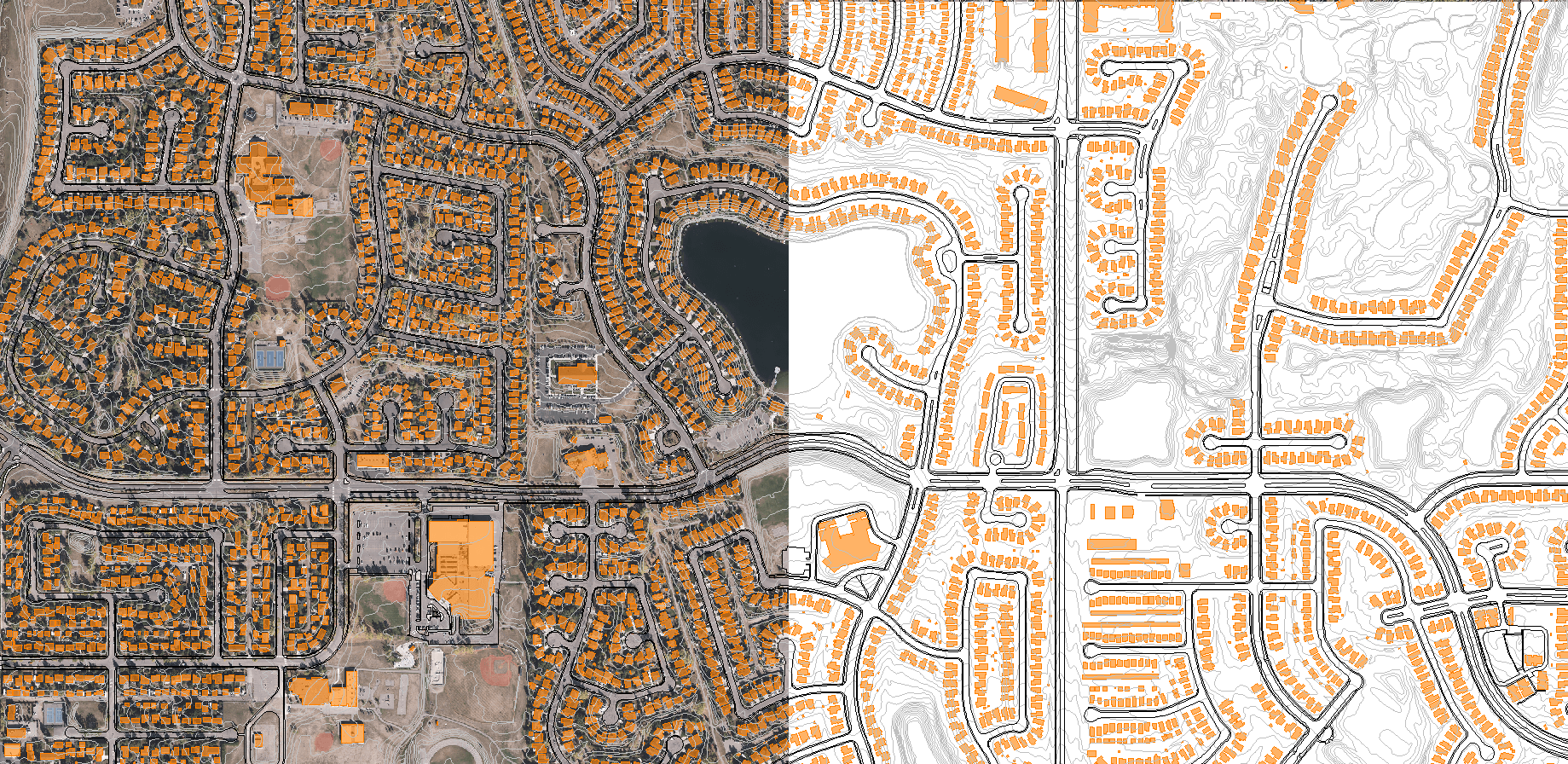
We provide classified LiDAR point clouds, digital terrain models (DTMs), digital surface models (DSMs), orthomosaic imagery, 3D models, and GIS-compatible vector data, all tailored to project specifications.
DELIVERING HIGH-QUALITY AERIAL SURVEYS WHEREVER YOU NEED
GLOBAL REACH, LOCAL PRECISION
Our services are available worldwide. Whether your project is in remote areas, across challenging terrain, or in urban landscapes, our team can deploy an equipped aircraft to capture precise data wherever you need it.
With operational capabilities spanning continents, we bring advanced geospatial solutions directly to your location, ensuring that distance and geography are never barriers to high-quality aerial data.
We are continuously engaged in fascinating projects with inspirational clients!
"Wooding Geospatial Solutions have come up with an effective solution to the problem we were faced with. Thank you and we are looking forward to working with this team on our next project!"
Scott V.
"The service was excellent. The survey that Wooding Geospatial Solutions did for us was handled efficiently and professionally. We were very happy with the reports. Highly recommended!"
James S.
"We received the data, and are extremely happy with it. From the quality of the imagery to the extent of the final deliverables, it’s easily one of the best Orthophotography projects we’ve been involved in."
Rob M. - Vermillion County
"The LiDAR data has been a HUGE help, not only for drill planning but we have also been able to find a bunch of new outcrops now have been in the forest."
Pete S. - Virginia Mining Corporation
"Wooding Geospatial Solutions is a professional organisation and all work has been delivered timeously and to specification."
Patrick G. - GeodesyGroup Inc.
READY TO ELEVATE YOUR RENEWABLE OPERATIONS?
Leverage the power of LiDAR and aerial imagery to make data-driven decisions and achieve your management goals.