Introduction
Aerial surveys play a vital role across industries, including agriculture, land development, ecological studies, and urban planning. Traditionally, either drones or dedicated survey aircraft performed these surveys, but both approaches have limitations. Drones, though effective, struggle with battery life, payload capacity, and regulatory restrictions, which complicates large-scale or urban projects. Meanwhile, dedicated survey aircraft demand high operational costs and present logistical challenges.
Now, the survey pod emerges as a game-changing solution, merging the strengths of drones and aircraft to revolutionize aerial surveys. In this article, we’ll explore how survey pods transform aerial data collection, enabling more affordable, efficient, and flexible operations than ever before.
What is the Survey Pod?
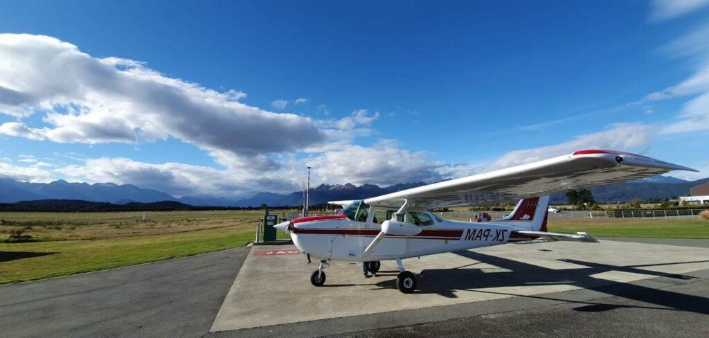
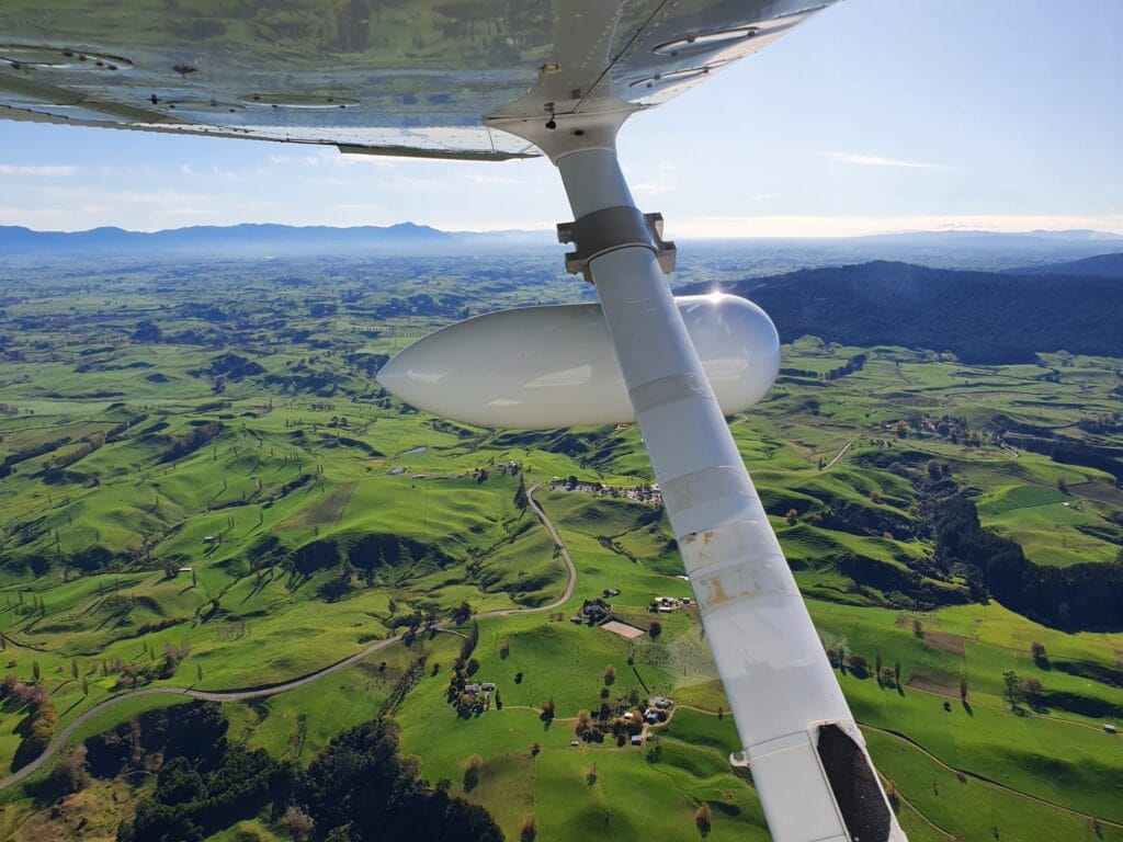
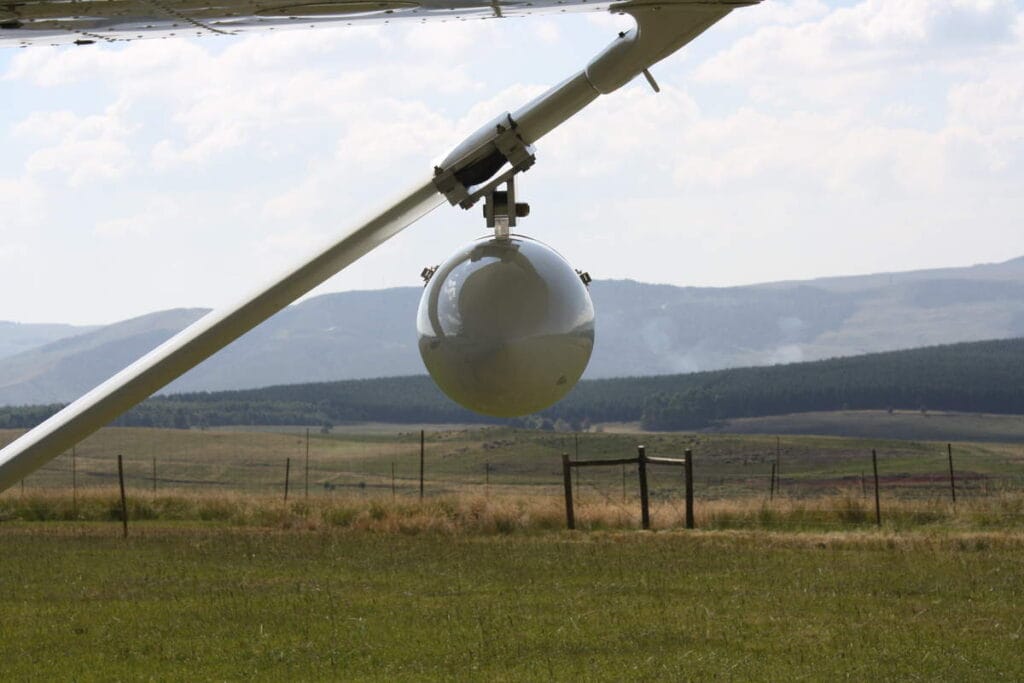
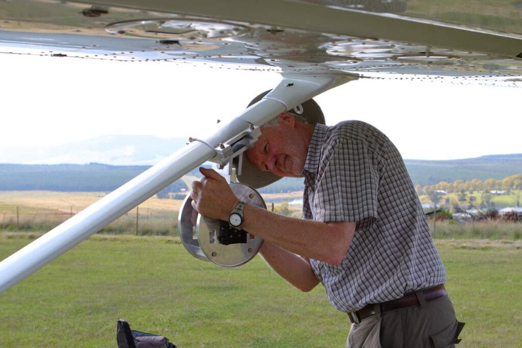
The survey pod is a lightweight, versatile system that attaches to various light aircraft. It holds imaging and data-collection equipment including photogrammetric, multispectral, LiDAR, and thermal sensors. Certified by aviation authorities, it fits many popular aircraft models and sets up in under five minutes. This quick deployment makes it perfect for rapid, on-demand aerial surveys.
What are the benefits of using the Survey Pod for Aerial Surveys?
The survey pod offers several advantages over traditional aerial survey methods, making it an appealing option for industries needing reliable, high-resolution data. Here are some of the key benefits:
Using light aircraft instead of dedicated survey planes significantly reduces costs while maintaining high data quality. This ensures that even budget-conscious projects can benefit from reliable aerial surveys.
The pod supports various sensors, such as those for capturing vegetation indices in agriculture or high-resolution images for urban planning. Consequently, it easily adapts to diverse project requirements.
Operators can quickly and easily attach the pod to the aircraft, minimizing downtime. As a result, more time is available for gathering valuable data.
Unlike drones, which are constrained by battery life, light aircraft with the survey pod cover vast areas. For instance, they are ideal for surveying hundreds or even thousands of square kilometers.
The survey pod excels in areas inaccessible by road or unsuitable for drones. For example, it performs well in remote landscapes, coastal regions, and rugged terrain, ensuring consistent results in challenging environments.
Applications of the Survey Pod in Aerial Surveys
The survey pod is used across a variety of sectors, thanks to its flexibility and adaptability. Here are some popular applications:
1. Agriculture & Vegetation Studies
Agriculture relies heavily on accurate, up-to-date data to monitor crop health and optimize yields. The survey pod, equipped with multispectral or infrared sensors, can capture NDVI (Normalized Difference Vegetation Index) data to assess vegetation health and detect issues such as drought stress, pest infestation, and nutrient deficiencies. This information allows farmers to take timely action to maximize productivity.
2. Engineering & Land Development
For engineers and planners, accurate aerial data is vital for infrastructure projects and land management. The survey pod provides high-resolution imagery and digital terrain models (DTMs) that support site assessment, route planning, and environmental impact studies. This data is critical for efficient project planning and helps in identifying potential challenges early in the process.
3. Ecological & Wildlife Surveys
Conservationists and researchers can benefit from the survey pod’s ability to cover large, remote areas. Using thermal imaging and multispectral sensors, the pod can monitor wildlife populations, track habitat changes, and assess environmental health. These surveys are invaluable for informing conservation strategies, studying biodiversity, and understanding ecosystems.
4. Urban Modelling & Smart Cities
Urban planners are increasingly turning to 3D mapping to design smarter, more efficient cities. The survey pod can create detailed, high-resolution 3D models that aid in urban planning, infrastructure development, and disaster preparedness. These models provide an accurate representation of the urban landscape, helping planners make informed decisions.
How the Aerial Survey Process Works with the Survey Pod
Using the survey pod for aerial surveys is designed to be straightforward and efficient:
- Request a Quote: Start by providing a few details about your project, including location, data requirements, and timeline. This helps us determine the best sensor package for your needs.
- Get Customized Options: Based on your requirements, we’ll recommend a customized survey setup, including the appropriate sensor payload and data processing options.
- Data Collection: Our team dispatches the survey pod to your chosen location, where it’s installed on a local aircraft. The pod-equipped aircraft captures high-quality data according to your specifications.
- Data Processing & Delivery: After data collection, our processing team can provide additional services such as orthophoto creation, 3D modeling, and vegetation indices. You’ll receive fully processed data ready for analysis and integration into your workflows.
Conclusion
The survey pod represents a significant advancement in the field of aerial surveys, offering a reliable, versatile, and cost-effective alternative to traditional methods. By combining ease of deployment with the ability to capture detailed, high-quality data, the survey pod is helping industries around the world harness the power of aerial data.
If you’re interested in learning more about how the survey pod can benefit your project, contact us today to discuss your needs and get a customized quote.
