TRANSFORMING UTILITY INFRASTRUCTURE WITH SURVEYING TECHNOLOGY
Utility surveys provide essential geospatial data to map and assess service networks such as water, gas, electricity, and telecommunications. These surveys ensure accurate network planning, efficient maintenance, and safer utility operations, from initial site assessments to ongoing infrastructure monitoring. The key solutions we offer include:
Create immersive, data-rich 3D models of utility networks
KEY FEATURES
PRECISION DATA FOR UTILITY NETWORK DESIGN AND MONITORING
Our utility survey solutions leverage cutting-edge technology, including LiDAR and high-resolution imagery, to deliver actionable data for project design, construction, and maintenance planning.
Create accurate digital twins for design verification and as-built documentation.
INDUSTRY APPLICATIONS
SUPPORTING UTILITY PROJECTS ACROSS SECTORS
Our utility survey solutions provide the precision data needed for efficient network design and maintenance. We support utility projects across various sectors, ensuring optimal infrastructure planning and service delivery.
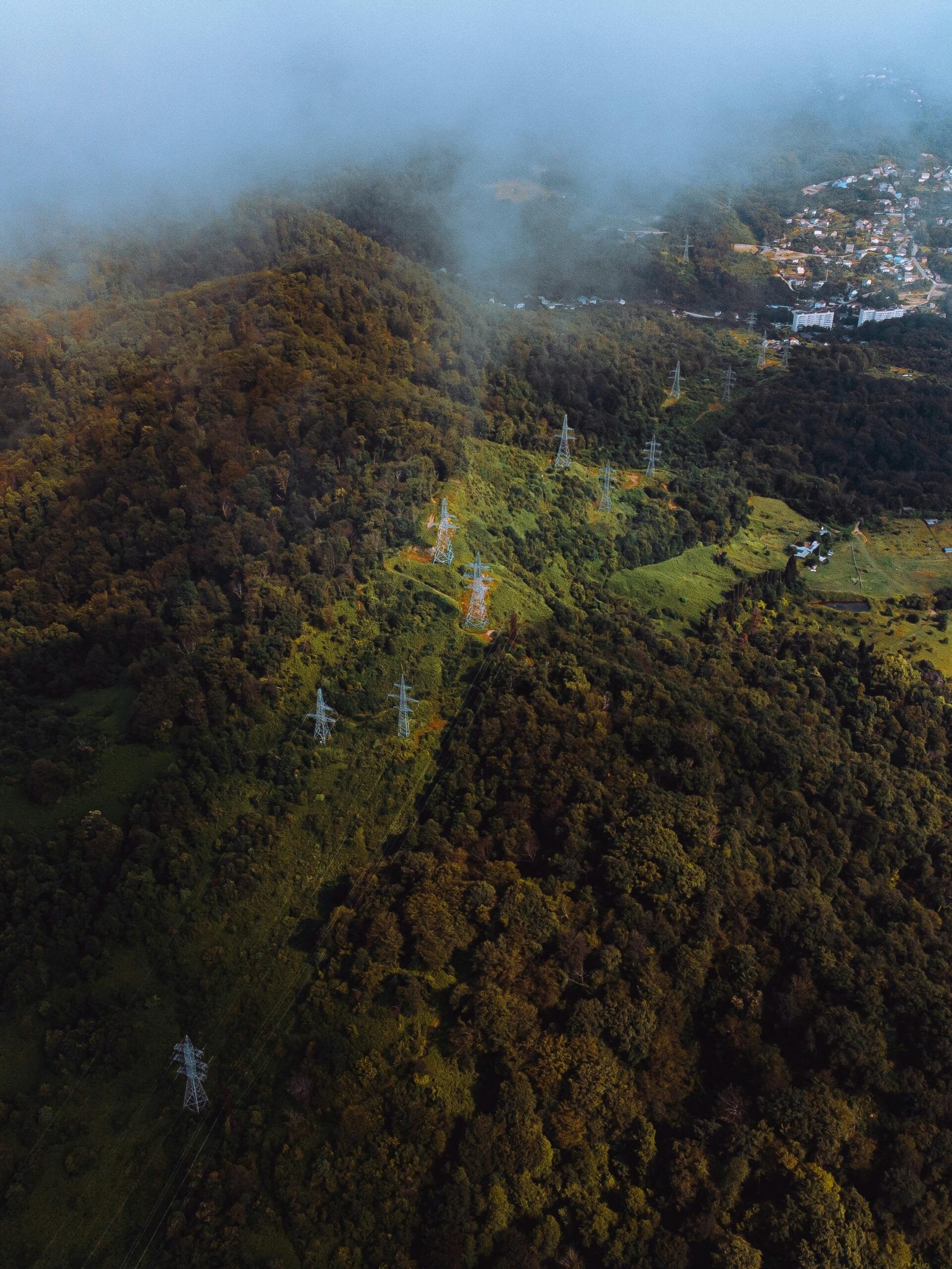
Energy Networks
Design and optimize power transmission and distribution systems.
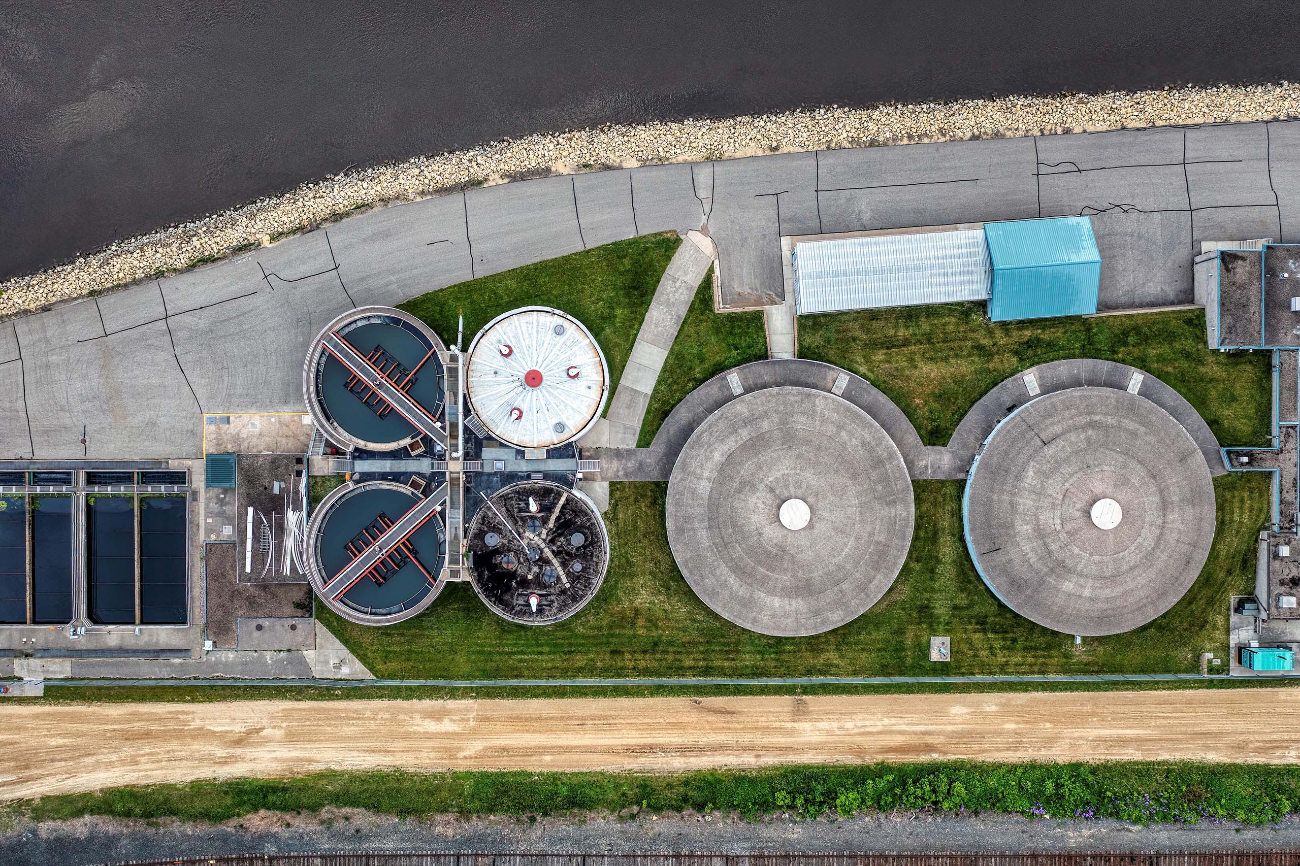
Water and Wastewater Infrastructure
Plan and monitor water and sewer networks for maintenance and expansion.
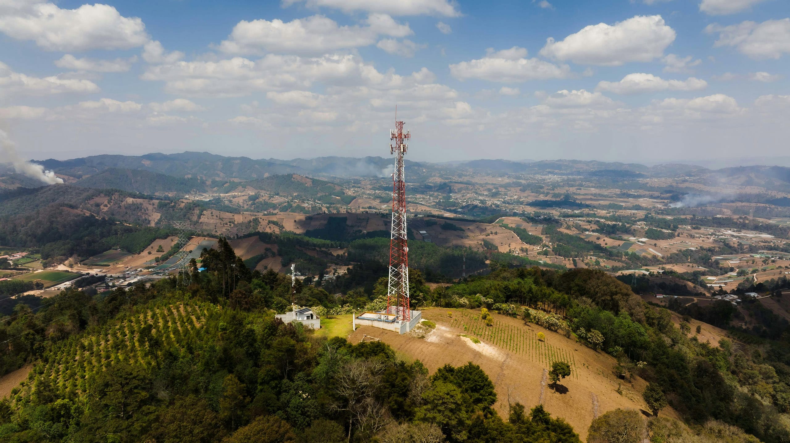
Telecommunications
Support the planning and maintenance of fibre optic, cellular, and broadband networks.
Gas Distribution
Monitor and maintain natural gas pipelines and distribution systems.
HOW IT WORKS
SEAMLESS AERIAL SURVEYING FOR UTILITY PROJECTS
We’ve streamlined our aerial survey process to deliver fast, accurate, and actionable data to keep your projects moving forward. Our end-to-end service ensures you get the insights you need with minimal disruption to your operations.
1
Project Consultation & Planning
We begin by understanding your project requirements, defining the survey scope, and planning the optimal data capture strategy tailored to your objectives.
2
Data Acquisition
Using state-of-the-art aerial platforms equipped with LiDAR and high-resolution cameras, we capture precise geospatial data across your project area quickly and safely.
3
Data Processing & Analysis
Our expert team processes the captured data, generating topographic maps, 3D models, and GIS-ready datasets with the highest accuracy standards.
4
Data Delivery & Insights
Receive your data in the formats you need, complete with actionable insights for design optimization, project monitoring, and compliance reporting.
Our LiDAR surveys achieve vertical accuracy within ±5 cm and horizontal accuracy within ±10 cm, depending on terrain and flight altitude. Photogrammetry data typically delivers accuracy within ±2 pixels of ground sample distance (GSD).
We can deliver data in all standard coordinate systems, including WGS84, UTM, and national grids such as OSGB36. Custom projections and local datum transformations are also supported upon request.
Our LiDAR captures can exceed 50 points per square meter, while our aerial imagery can achieve resolutions as fine as 2 cm per pixel, providing highly detailed surface models and orthophotos.
We deploy a network of surveyed ground control points (GCPs) and check points using GNSS RTK technology to ensure data accuracy, even in complex or vegetated terrains.
We provide classified LiDAR point clouds, digital terrain models (DTMs), digital surface models (DSMs), orthomosaic imagery, 3D models, and GIS-compatible vector data, all tailored to project specifications.
DELIVERING HIGH-QUALITY AERIAL SURVEYS WHEREVER YOU NEED
GLOBAL REACH, LOCAL PRECISION
Our services are available worldwide. Whether your project is in remote areas, across challenging terrain, or in urban landscapes, our team can deploy an equipped aircraft to capture precise data wherever you need it.
With operational capabilities spanning continents, we bring advanced geospatial solutions directly to your location, ensuring that distance and geography are never barriers to high-quality aerial data.
We are continuously engaged in fascinating projects with inspirational clients!
"Wooding Geospatial Solutions have come up with an effective solution to the problem we were faced with. Thank you and we are looking forward to working with this team on our next project!"
Scott V.
"The service was excellent. The survey that Wooding Geospatial Solutions did for us was handled efficiently and professionally. We were very happy with the reports. Highly recommended!"
James S.
"We received the data, and are extremely happy with it. From the quality of the imagery to the extent of the final deliverables, it’s easily one of the best Orthophotography projects we’ve been involved in."
Rob M. - Vermillion County
"The LiDAR data has been a HUGE help, not only for drill planning but we have also been able to find a bunch of new outcrops now have been in the forest."
Pete S. - Virginia Mining Corporation
"Wooding Geospatial Solutions is a professional organisation and all work has been delivered timeously and to specification."
Patrick G. - GeodesyGroup Inc.
READY TO ELEVATE YOUR UTILITY OPERATIONS?
Leverage the power of LiDAR and aerial imagery to make data-driven decisions and achieve your management goals.