Comprehensive Topographical Data for Wind Farm Planning
Effective wind farm planning hinges on high-quality topographical data, essential for the precise positioning of turbines and the strategic planning of access roads, platforms, and electrical reticulation systems. Accurate terrain models are also crucial for wind modelling, directly influencing turbine efficiency and overall energy production.
Our skilled team specialise in providing aerial survey and mapping services tailored for wind farm projects. Leveraging advanced technologies such as LiDAR, high-resolution imagery, and drone surveys, we deliver detailed topographical data that supports the meticulous planning and development of wind energy installations.
A Commitmnet to Quality and Innovation
Beyond topographical mapping, WGS’s services contribute to the creation of accurate terrain models, which are vital for wind modelling. Utilising tools, WGS can predict wind climates, wind resources, and energy yields from wind turbines and wind farms. This comprehensive approach ensures that wind farm designs are optimized for maximum efficiency and energy production.
By integrating cutting-edge technology with a deep understanding of geospatial challenges, we provide tailored solutions that meet the unique requirements of each wind farm project. Our comprehensive suite of services and expertise in wind farm mapping and planning plays a pivotal role in the successful development of wind energy projects, ensuring optimal turbine placement, efficient infrastructure planning, and accurate wind modelling.
Our Case Study
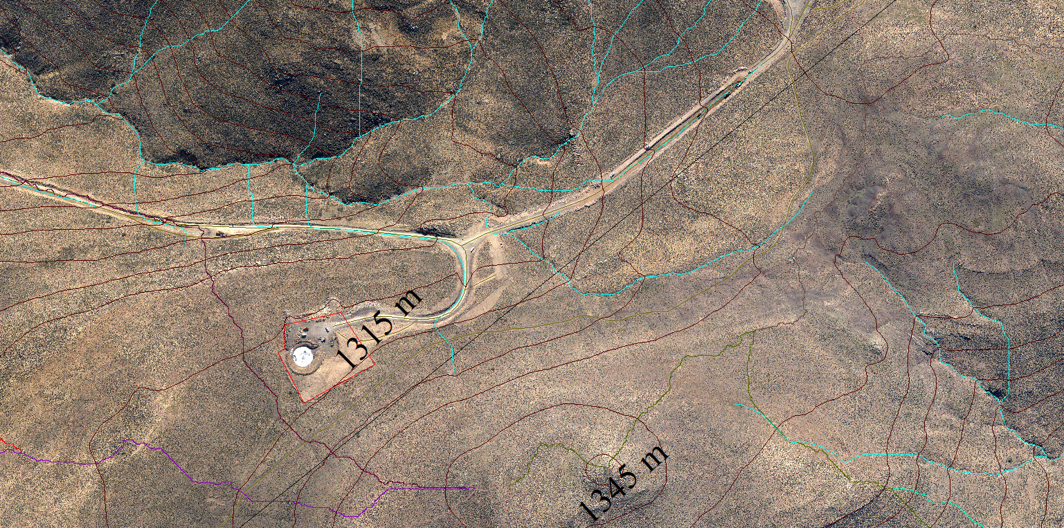
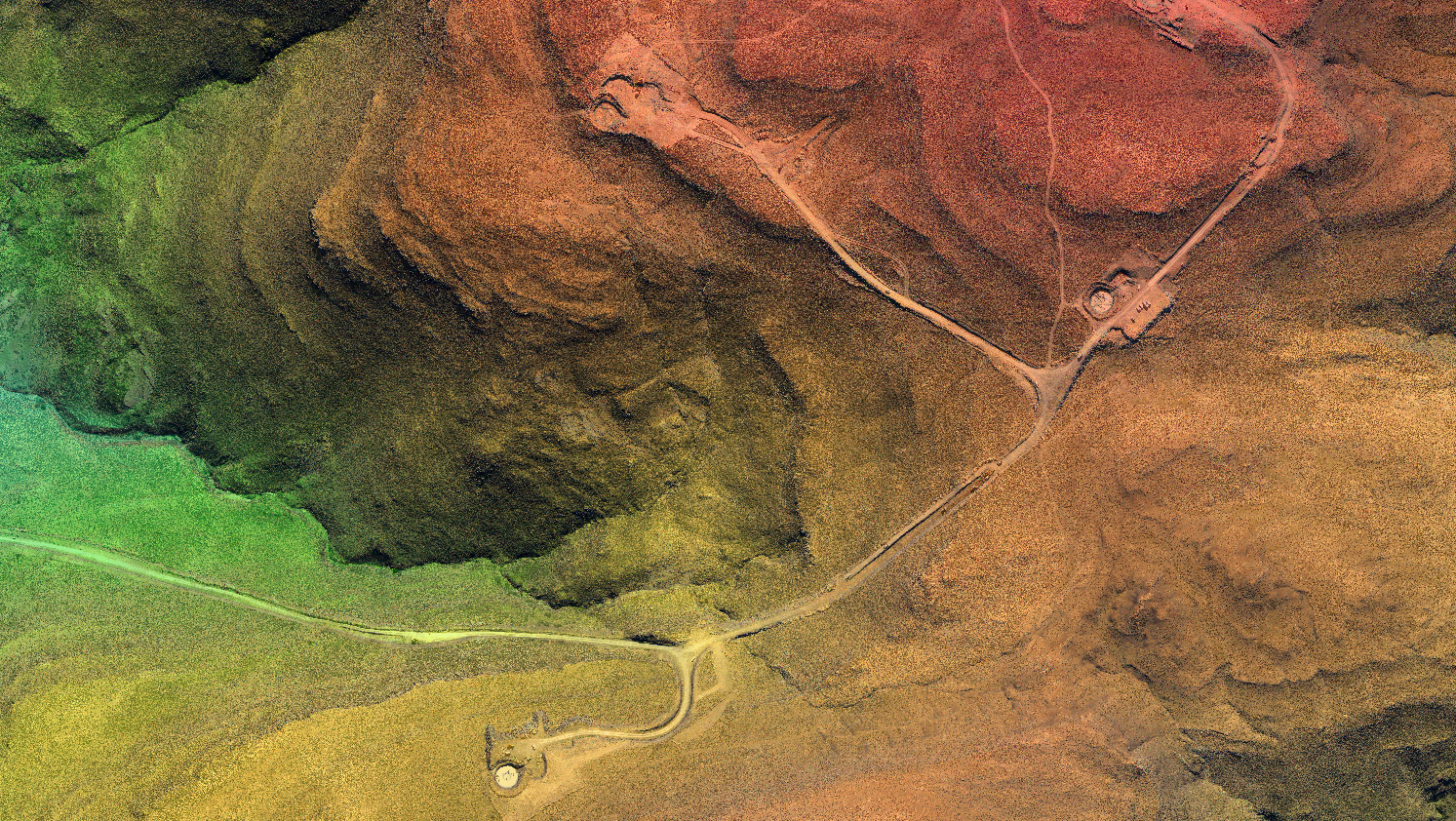
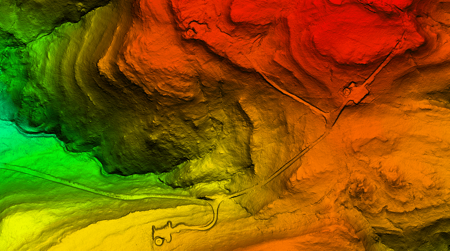
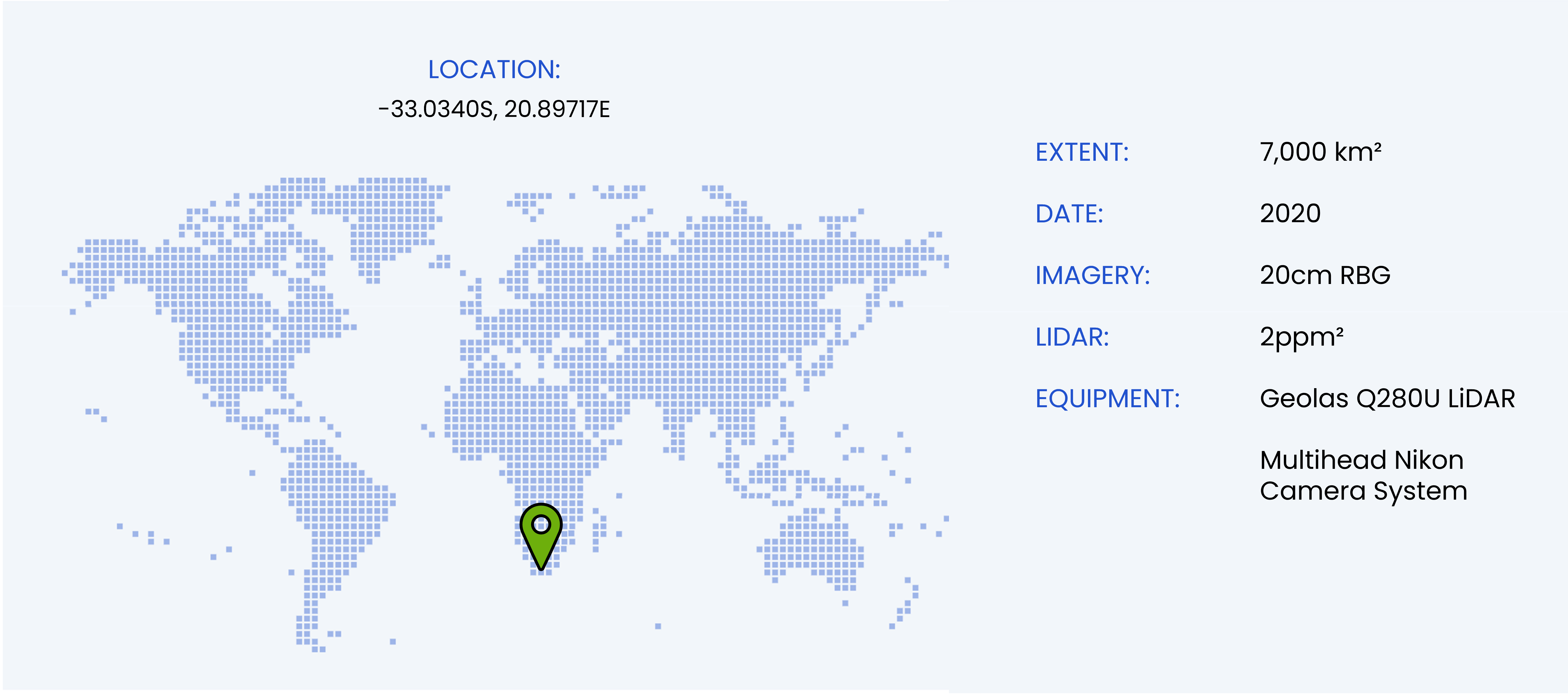
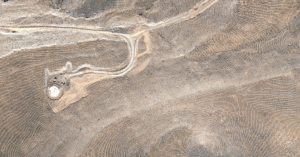
In 2020, a large-scale wind farm mapping project was conducted in the Great Karoo Desert using high-resolution remote sensing technologies. The project utilized RGB imagery, providing detailed visual data to support land assessment and infrastructure planning. Additionally, LiDAR data was collected, offering precise elevation and terrain information crucial for optimizing turbine placement and environmental impact assessments. This comprehensive dataset enabled accurate site analysis, ensuring efficient wind farm development while minimizing ecological disruption.